You are here: Home > Network List > TA - USArray Transportable Network (new EarthScope stations) Stations List
> Station O37A Wolven Farm, McFall, MO, USA > Earthquake Result Viewer
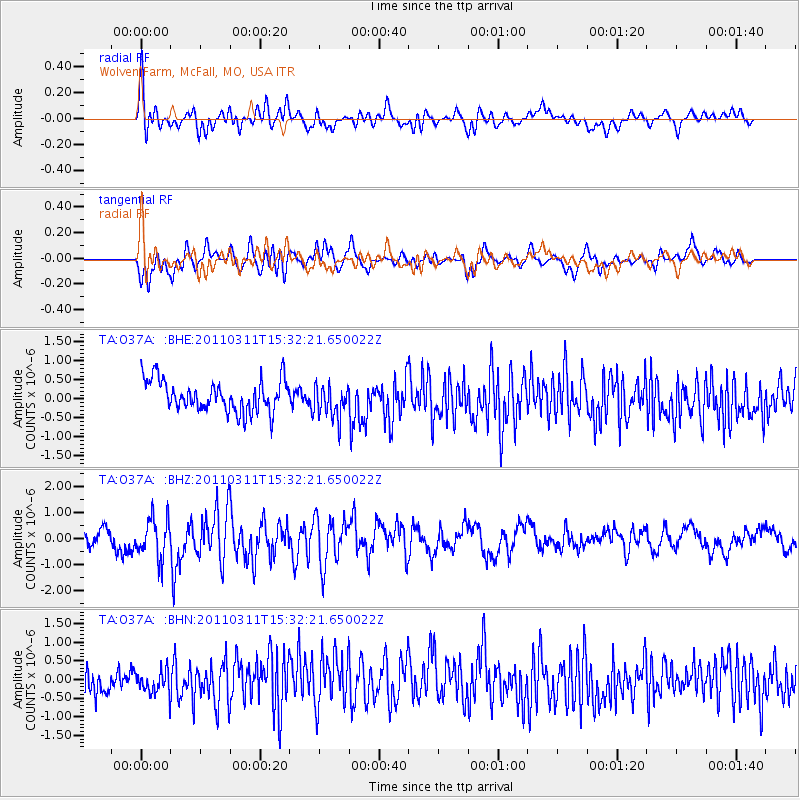
O37A Wolven Farm, McFall, MO, USA - Earthquake Result Viewer
*The percent match for this event was below the threshold and hence no stack was calculated.
| Earthquake location: |
Near East Coast Of Honshu, Japan |
| Earthquake latitude/longitude: |
36.4/141.9 |
| Earthquake time(UTC): |
2011/03/11 (070) 15:20:08 GMT |
| Earthquake Depth: |
53 km |
| Earthquake Magnitude: |
6.0 MB |
| Earthquake Catalog/Contributor: |
WHDF/NEIC |
|
| Network: |
TA USArray Transportable Network (new EarthScope stations) |
| Station: |
O37A Wolven Farm, McFall, MO, USA |
| Lat/Lon: |
40.17 N/94.15 W |
| Elevation: |
284 m |
|
| Distance: |
88.1 deg |
| Az: |
39.475 deg |
| Baz: |
317.984 deg |
| Ray Param: |
$rayparam |
*The percent match for this event was below the threshold and hence was not used in the summary stack. |
|
| Radial Match: |
70.01155 % |
| Radial Bump: |
400 |
| Transverse Match: |
71.02102 % |
| Transverse Bump: |
400 |
| SOD ConfigId: |
356183 |
| Insert Time: |
2011-08-17 08:01:07.113 +0000 |
| GWidth: |
2.5 |
| Max Bumps: |
400 |
| Tol: |
0.001 |
|
Signal To Noise
| Channel | StoN | STA | LTA |
| TA:O37A: :BHZ:20110311T15:32:21.650022Z | 1.8702506 | 7.7430826E-7 | 4.140131E-7 |
| TA:O37A: :BHN:20110311T15:32:21.650022Z | 0.94872075 | 3.205592E-7 | 3.3788572E-7 |
| TA:O37A: :BHE:20110311T15:32:21.650022Z | 1.0778176 | 4.4227497E-7 | 4.1034306E-7 |
| Arrivals |
| Ps | |
| PpPs | |
| PsPs/PpSs | |


