You are here: Home > Network List > TA - USArray Transportable Network (new EarthScope stations) Stations List
> Station G03D McMinnville, OR, USA > Earthquake Result Viewer
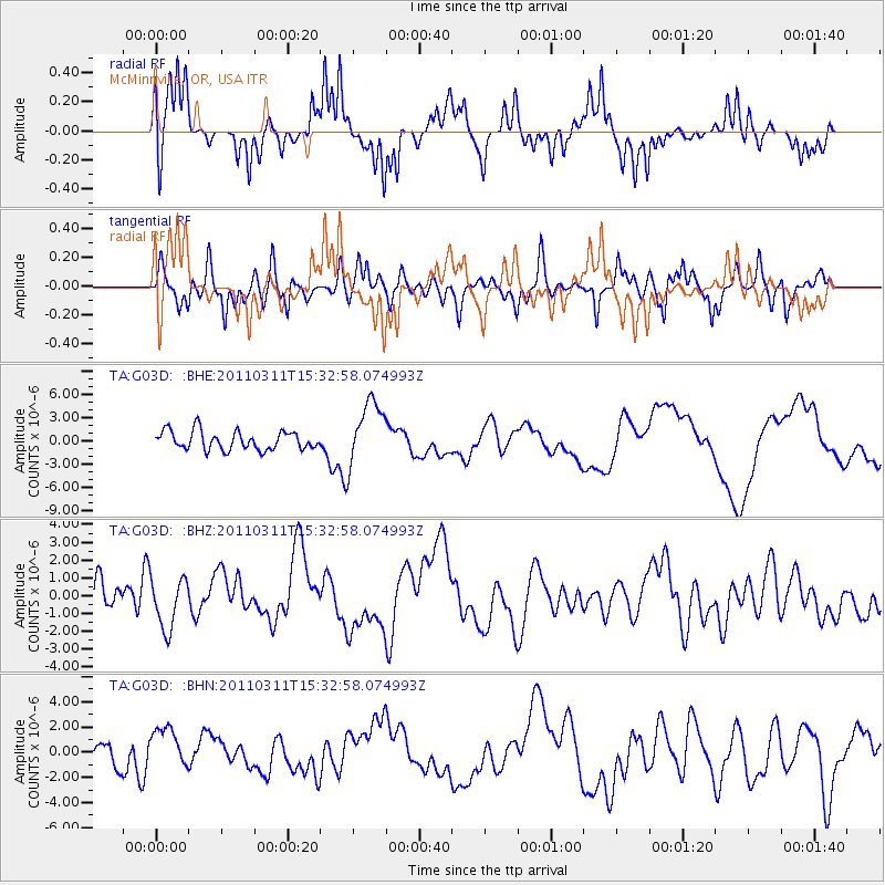
G03D McMinnville, OR, USA - Earthquake Result Viewer
*The percent match for this event was below the threshold and hence no stack was calculated.
| Earthquake location: |
Near East Coast Of Honshu, Japan |
| Earthquake latitude/longitude: |
35.6/141.5 |
| Earthquake time(UTC): |
2011/03/11 (070) 15:22:27 GMT |
| Earthquake Depth: |
35 km |
| Earthquake Magnitude: |
5.5 MB |
| Earthquake Catalog/Contributor: |
WHDF/NEIC |
|
| Network: |
TA USArray Transportable Network (new EarthScope stations) |
| Station: |
G03D McMinnville, OR, USA |
| Lat/Lon: |
45.21 N/123.26 W |
| Elevation: |
222 m |
|
| Distance: |
69.0 deg |
| Az: |
48.94 deg |
| Baz: |
299.669 deg |
| Ray Param: |
$rayparam |
*The percent match for this event was below the threshold and hence was not used in the summary stack. |
|
| Radial Match: |
65.97104 % |
| Radial Bump: |
315 |
| Transverse Match: |
52.036526 % |
| Transverse Bump: |
345 |
| SOD ConfigId: |
356183 |
| Insert Time: |
2011-08-17 09:39:58.103 +0000 |
| GWidth: |
2.5 |
| Max Bumps: |
400 |
| Tol: |
0.001 |
|
Signal To Noise
| Channel | StoN | STA | LTA |
| TA:G03D: :BHZ:20110311T15:32:58.074993Z | 0.93007743 | 1.3537812E-6 | 1.4555575E-6 |
| TA:G03D: :BHN:20110311T15:32:58.074993Z | 1.9461061 | 1.8326743E-6 | 9.417135E-7 |
| TA:G03D: :BHE:20110311T15:32:58.074993Z | 3.4300196 | 4.132693E-6 | 1.2048598E-6 |
| Arrivals |
| Ps | |
| PpPs | |
| PsPs/PpSs | |


