You are here: Home > Network List > TA - USArray Transportable Network (new EarthScope stations) Stations List
> Station R36A Gordon, Harris, KS, USA > Earthquake Result Viewer
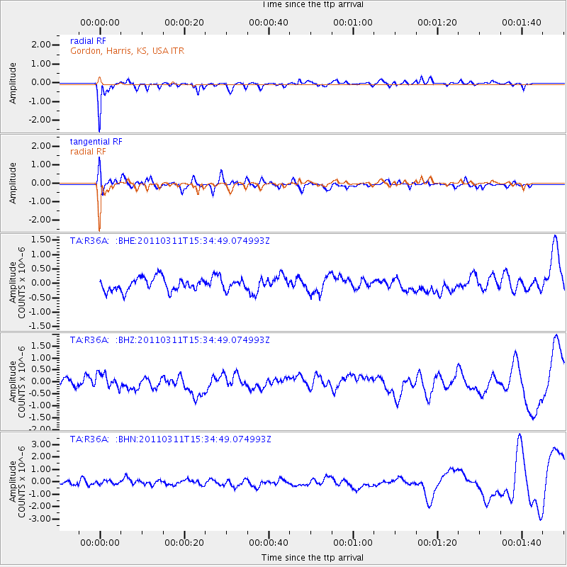
R36A Gordon, Harris, KS, USA - Earthquake Result Viewer
*The percent match for this event was below the threshold and hence no stack was calculated.
| Earthquake location: |
Near East Coast Of Honshu, Japan |
| Earthquake latitude/longitude: |
35.6/141.5 |
| Earthquake time(UTC): |
2011/03/11 (070) 15:22:27 GMT |
| Earthquake Depth: |
35 km |
| Earthquake Magnitude: |
5.5 MB |
| Earthquake Catalog/Contributor: |
WHDF/NEIC |
|
| Network: |
TA USArray Transportable Network (new EarthScope stations) |
| Station: |
R36A Gordon, Harris, KS, USA |
| Lat/Lon: |
38.32 N/95.50 W |
| Elevation: |
354 m |
|
| Distance: |
89.4 deg |
| Az: |
41.305 deg |
| Baz: |
316.875 deg |
| Ray Param: |
$rayparam |
*The percent match for this event was below the threshold and hence was not used in the summary stack. |
|
| Radial Match: |
74.16291 % |
| Radial Bump: |
347 |
| Transverse Match: |
42.726345 % |
| Transverse Bump: |
400 |
| SOD ConfigId: |
356183 |
| Insert Time: |
2011-08-17 09:49:02.096 +0000 |
| GWidth: |
2.5 |
| Max Bumps: |
400 |
| Tol: |
0.001 |
|
Signal To Noise
| Channel | StoN | STA | LTA |
| TA:R36A: :BHZ:20110311T15:34:49.074993Z | 1.0855329 | 3.065885E-7 | 2.8243133E-7 |
| TA:R36A: :BHN:20110311T15:34:49.074993Z | 0.9340959 | 3.8164316E-7 | 4.0856958E-7 |
| TA:R36A: :BHE:20110311T15:34:49.074993Z | 0.6826198 | 1.5496904E-7 | 2.27021E-7 |
| Arrivals |
| Ps | |
| PpPs | |
| PsPs/PpSs | |


