You are here: Home > Network List > TA - USArray Transportable Network (new EarthScope stations) Stations List
> Station 833A Chaparral WMA, Artesia Wells, TX, USA > Earthquake Result Viewer
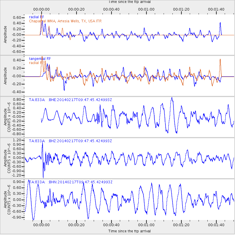
833A Chaparral WMA, Artesia Wells, TX, USA - Earthquake Result Viewer
*The percent match for this event was below the threshold and hence no stack was calculated.
| Earthquake location: |
Northern Colombia |
| Earthquake latitude/longitude: |
6.5/-71.7 |
| Earthquake time(UTC): |
2014/02/17 (048) 09:41:35 GMT |
| Earthquake Depth: |
41 km |
| Earthquake Magnitude: |
5.3 MW |
| Earthquake Catalog/Contributor: |
ISC/ISC |
|
| Network: |
TA USArray Transportable Network (new EarthScope stations) |
| Station: |
833A Chaparral WMA, Artesia Wells, TX, USA |
| Lat/Lon: |
28.32 N/99.39 W |
| Elevation: |
171 m |
|
| Distance: |
34.0 deg |
| Az: |
312.901 deg |
| Baz: |
124.353 deg |
| Ray Param: |
$rayparam |
*The percent match for this event was below the threshold and hence was not used in the summary stack. |
|
| Radial Match: |
57.969612 % |
| Radial Bump: |
400 |
| Transverse Match: |
49.40632 % |
| Transverse Bump: |
308 |
| SOD ConfigId: |
3390531 |
| Insert Time: |
2019-04-10 08:54:37.389 +0000 |
| GWidth: |
2.5 |
| Max Bumps: |
400 |
| Tol: |
0.001 |
|
Signal To Noise
| Channel | StoN | STA | LTA |
| TA:833A: :BHZ:20140217T09:47:45.424993Z | 1.4652234 | 4.88437E-7 | 3.3335326E-7 |
| TA:833A: :BHN:20140217T09:47:45.424993Z | 0.52425766 | 2.1044681E-7 | 4.0141867E-7 |
| TA:833A: :BHE:20140217T09:47:45.424993Z | 1.1433418 | 2.1709185E-7 | 1.8987487E-7 |
| Arrivals |
| Ps | |
| PpPs | |
| PsPs/PpSs | |


