You are here: Home > Network List > TA - USArray Transportable Network (new EarthScope stations) Stations List
> Station E62A Clayton Lake, ME, USA > Earthquake Result Viewer
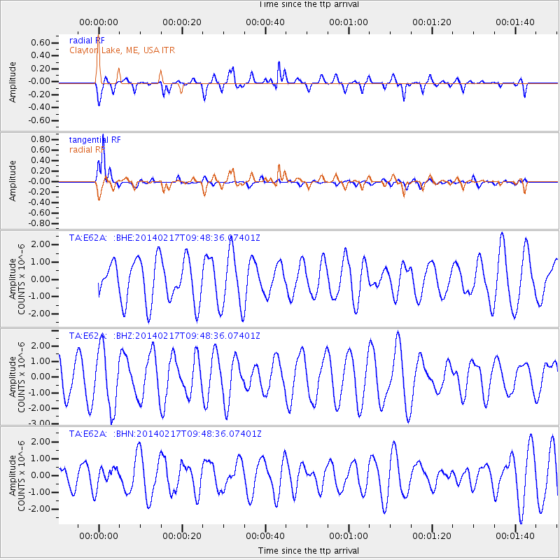
E62A Clayton Lake, ME, USA - Earthquake Result Viewer
*The percent match for this event was below the threshold and hence no stack was calculated.
| Earthquake location: |
Northern Colombia |
| Earthquake latitude/longitude: |
6.5/-71.7 |
| Earthquake time(UTC): |
2014/02/17 (048) 09:41:35 GMT |
| Earthquake Depth: |
41 km |
| Earthquake Magnitude: |
5.3 MW |
| Earthquake Catalog/Contributor: |
ISC/ISC |
|
| Network: |
TA USArray Transportable Network (new EarthScope stations) |
| Station: |
E62A Clayton Lake, ME, USA |
| Lat/Lon: |
46.62 N/69.52 W |
| Elevation: |
356 m |
|
| Distance: |
40.0 deg |
| Az: |
2.341 deg |
| Baz: |
183.376 deg |
| Ray Param: |
$rayparam |
*The percent match for this event was below the threshold and hence was not used in the summary stack. |
|
| Radial Match: |
77.42928 % |
| Radial Bump: |
400 |
| Transverse Match: |
91.32379 % |
| Transverse Bump: |
287 |
| SOD ConfigId: |
3390531 |
| Insert Time: |
2019-04-10 08:54:46.358 +0000 |
| GWidth: |
2.5 |
| Max Bumps: |
400 |
| Tol: |
0.001 |
|
Signal To Noise
| Channel | StoN | STA | LTA |
| TA:E62A: :BHZ:20140217T09:48:36.07401Z | 1.3026698 | 1.8924519E-6 | 1.4527487E-6 |
| TA:E62A: :BHN:20140217T09:48:36.07401Z | 0.97515476 | 5.6242055E-7 | 5.7675004E-7 |
| TA:E62A: :BHE:20140217T09:48:36.07401Z | 1.3892807 | 1.6582305E-6 | 1.1935894E-6 |
| Arrivals |
| Ps | |
| PpPs | |
| PsPs/PpSs | |


