You are here: Home > Network List > TA - USArray Transportable Network (new EarthScope stations) Stations List
> Station Q24A Divide, CO, USA > Earthquake Result Viewer
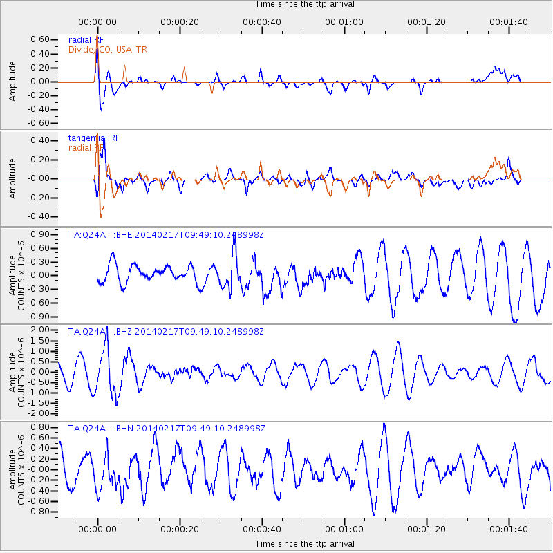
Q24A Divide, CO, USA - Earthquake Result Viewer
*The percent match for this event was below the threshold and hence no stack was calculated.
| Earthquake location: |
Northern Colombia |
| Earthquake latitude/longitude: |
6.5/-71.7 |
| Earthquake time(UTC): |
2014/02/17 (048) 09:41:35 GMT |
| Earthquake Depth: |
41 km |
| Earthquake Magnitude: |
5.3 MW |
| Earthquake Catalog/Contributor: |
ISC/ISC |
|
| Network: |
TA USArray Transportable Network (new EarthScope stations) |
| Station: |
Q24A Divide, CO, USA |
| Lat/Lon: |
38.96 N/105.15 W |
| Elevation: |
2775 m |
|
| Distance: |
44.2 deg |
| Az: |
321.938 deg |
| Baz: |
128.211 deg |
| Ray Param: |
$rayparam |
*The percent match for this event was below the threshold and hence was not used in the summary stack. |
|
| Radial Match: |
61.94359 % |
| Radial Bump: |
400 |
| Transverse Match: |
69.6034 % |
| Transverse Bump: |
400 |
| SOD ConfigId: |
3390531 |
| Insert Time: |
2019-04-10 08:55:27.294 +0000 |
| GWidth: |
2.5 |
| Max Bumps: |
400 |
| Tol: |
0.001 |
|
Signal To Noise
| Channel | StoN | STA | LTA |
| TA:Q24A: :BHZ:20140217T09:49:10.248998Z | 2.859954 | 1.1055058E-6 | 3.8654667E-7 |
| TA:Q24A: :BHN:20140217T09:49:10.248998Z | 1.3892986 | 3.1583852E-7 | 2.2733667E-7 |
| TA:Q24A: :BHE:20140217T09:49:10.248998Z | 1.9782768 | 3.6041618E-7 | 1.8218692E-7 |
| Arrivals |
| Ps | |
| PpPs | |
| PsPs/PpSs | |


