You are here: Home > Network List > US - United States National Seismic Network Stations List
> Station MSO Missoula, Montana, USA > Earthquake Result Viewer
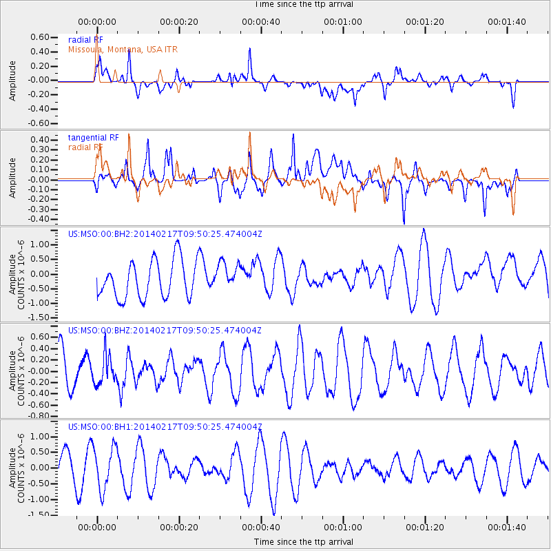
MSO Missoula, Montana, USA - Earthquake Result Viewer
*The percent match for this event was below the threshold and hence no stack was calculated.
| Earthquake location: |
Northern Colombia |
| Earthquake latitude/longitude: |
6.5/-71.7 |
| Earthquake time(UTC): |
2014/02/17 (048) 09:41:35 GMT |
| Earthquake Depth: |
41 km |
| Earthquake Magnitude: |
5.3 MW |
| Earthquake Catalog/Contributor: |
ISC/ISC |
|
| Network: |
US United States National Seismic Network |
| Station: |
MSO Missoula, Montana, USA |
| Lat/Lon: |
46.83 N/113.94 W |
| Elevation: |
1264 m |
|
| Distance: |
54.0 deg |
| Az: |
325.233 deg |
| Baz: |
124.394 deg |
| Ray Param: |
$rayparam |
*The percent match for this event was below the threshold and hence was not used in the summary stack. |
|
| Radial Match: |
40.33518 % |
| Radial Bump: |
400 |
| Transverse Match: |
63.56888 % |
| Transverse Bump: |
400 |
| SOD ConfigId: |
3390531 |
| Insert Time: |
2019-04-10 08:56:08.286 +0000 |
| GWidth: |
2.5 |
| Max Bumps: |
400 |
| Tol: |
0.001 |
|
Signal To Noise
| Channel | StoN | STA | LTA |
| US:MSO:00:BHZ:20140217T09:50:25.474004Z | 0.3935768 | 2.5707863E-7 | 6.531854E-7 |
| US:MSO:00:BH1:20140217T09:50:25.474004Z | 1.2364588 | 6.798075E-7 | 5.4980194E-7 |
| US:MSO:00:BH2:20140217T09:50:25.474004Z | 0.7677437 | 4.90618E-7 | 6.3903883E-7 |
| Arrivals |
| Ps | |
| PpPs | |
| PsPs/PpSs | |


