You are here: Home > Network List > TA - USArray Transportable Network (new EarthScope stations) Stations List
> Station F32A Veblen, SD, USA > Earthquake Result Viewer
F32A Veblen, SD, USA - Earthquake Result Viewer
*The percent match for this event was below the threshold and hence no stack was calculated.
| Earthquake location: |
Off East Coast Of Honshu, Japan |
| Earthquake latitude/longitude: |
39.5/143.5 |
| Earthquake time(UTC): |
2011/03/11 (070) 16:11:30 GMT |
| Earthquake Depth: |
35 km |
| Earthquake Magnitude: |
5.5 MB |
| Earthquake Catalog/Contributor: |
WHDF/NEIC |
|
| Network: |
TA USArray Transportable Network (new EarthScope stations) |
| Station: |
F32A Veblen, SD, USA |
| Lat/Lon: |
45.87 N/97.13 W |
| Elevation: |
371 m |
|
| Distance: |
79.2 deg |
| Az: |
38.289 deg |
| Baz: |
316.645 deg |
| Ray Param: |
$rayparam |
*The percent match for this event was below the threshold and hence was not used in the summary stack. |
|
| Radial Match: |
69.40636 % |
| Radial Bump: |
400 |
| Transverse Match: |
64.75002 % |
| Transverse Bump: |
400 |
| SOD ConfigId: |
356183 |
| Insert Time: |
2011-08-17 12:39:25.860 +0000 |
| GWidth: |
2.5 |
| Max Bumps: |
400 |
| Tol: |
0.001 |
|
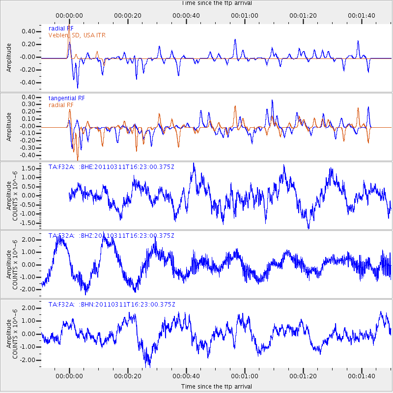
Signal To Noise
| Channel | StoN | STA | LTA |
| TA:F32A: :BHZ:20110311T16:23:00.375Z | 0.8206058 | 9.607842E-7 | 1.170823E-6 |
| TA:F32A: :BHN:20110311T16:23:00.375Z | 1.3383312 | 7.6556455E-7 | 5.7202925E-7 |
| TA:F32A: :BHE:20110311T16:23:00.375Z | 0.48447213 | 2.2581044E-7 | 4.6609583E-7 |
| Arrivals |
| Ps | |
| PpPs | |
| PsPs/PpSs | |


