You are here: Home > Network List > CI - Caltech Regional Seismic Network Stations List
> Station BAR Barrett, Tecate, CA, USA > Earthquake Result Viewer
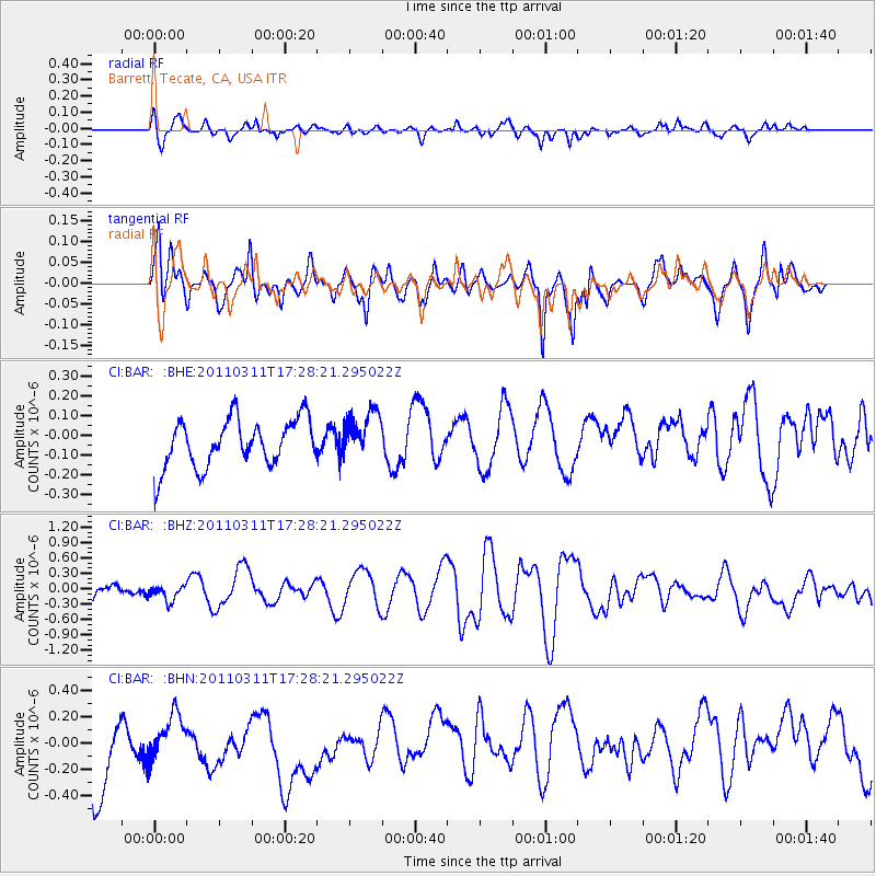
BAR Barrett, Tecate, CA, USA - Earthquake Result Viewer
*The percent match for this event was below the threshold and hence no stack was calculated.
| Earthquake location: |
Off East Coast Of Honshu, Japan |
| Earthquake latitude/longitude: |
37.0/144.2 |
| Earthquake time(UTC): |
2011/03/11 (070) 17:16:56 GMT |
| Earthquake Depth: |
9.3 km |
| Earthquake Magnitude: |
5.5 MB, 5.6 MS |
| Earthquake Catalog/Contributor: |
WHDF/NEIC |
|
| Network: |
CI Caltech Regional Seismic Network |
| Station: |
BAR Barrett, Tecate, CA, USA |
| Lat/Lon: |
32.68 N/116.67 W |
| Elevation: |
521 m |
|
| Distance: |
77.6 deg |
| Az: |
58.473 deg |
| Baz: |
305.985 deg |
| Ray Param: |
$rayparam |
*The percent match for this event was below the threshold and hence was not used in the summary stack. |
|
| Radial Match: |
58.726963 % |
| Radial Bump: |
400 |
| Transverse Match: |
57.752197 % |
| Transverse Bump: |
400 |
| SOD ConfigId: |
356183 |
| Insert Time: |
2011-08-17 13:22:41.018 +0000 |
| GWidth: |
2.5 |
| Max Bumps: |
400 |
| Tol: |
0.001 |
|
Signal To Noise
| Channel | StoN | STA | LTA |
| CI:BAR: :BHZ:20110311T17:28:21.295022Z | 0.54572654 | 2.700532E-7 | 4.948508E-7 |
| CI:BAR: :BHN:20110311T17:28:21.295022Z | 0.48318917 | 1.3958179E-7 | 2.8887607E-7 |
| CI:BAR: :BHE:20110311T17:28:21.295022Z | 0.98907906 | 1.1821926E-7 | 1.1952459E-7 |
| Arrivals |
| Ps | |
| PpPs | |
| PsPs/PpSs | |


