You are here: Home > Network List > US - United States National Seismic Network Stations List
> Station AMTX Amarillo, Texas, USA > Earthquake Result Viewer
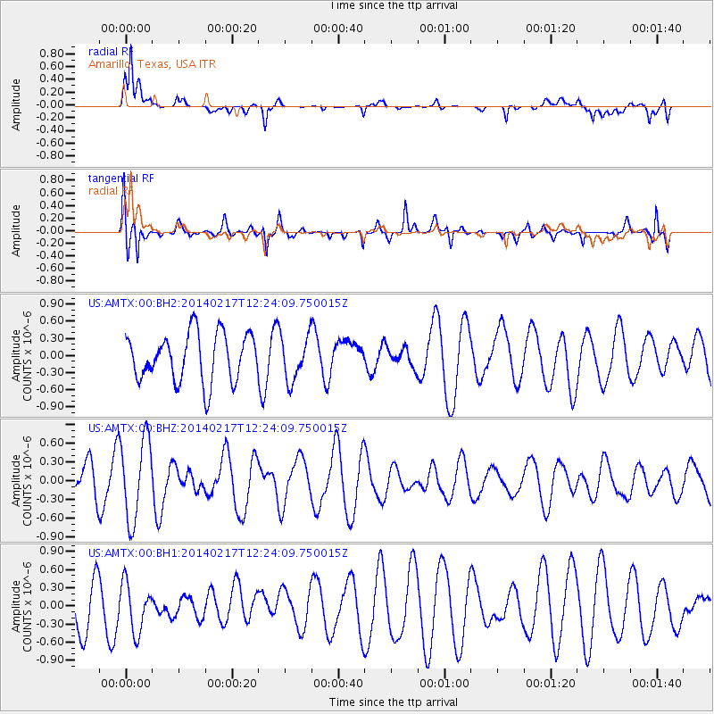
AMTX Amarillo, Texas, USA - Earthquake Result Viewer
*The percent match for this event was below the threshold and hence no stack was calculated.
| Earthquake location: |
Tonga Islands |
| Earthquake latitude/longitude: |
-17.8/-173.0 |
| Earthquake time(UTC): |
2014/02/17 (048) 12:12:05 GMT |
| Earthquake Depth: |
26 km |
| Earthquake Magnitude: |
5.0 MW |
| Earthquake Catalog/Contributor: |
ISC/ISC |
|
| Network: |
US United States National Seismic Network |
| Station: |
AMTX Amarillo, Texas, USA |
| Lat/Lon: |
34.53 N/101.41 W |
| Elevation: |
1010 m |
|
| Distance: |
85.7 deg |
| Az: |
51.798 deg |
| Baz: |
245.041 deg |
| Ray Param: |
$rayparam |
*The percent match for this event was below the threshold and hence was not used in the summary stack. |
|
| Radial Match: |
71.572014 % |
| Radial Bump: |
400 |
| Transverse Match: |
77.518684 % |
| Transverse Bump: |
400 |
| SOD ConfigId: |
3390531 |
| Insert Time: |
2019-04-10 09:01:13.322 +0000 |
| GWidth: |
2.5 |
| Max Bumps: |
400 |
| Tol: |
0.001 |
|
Signal To Noise
| Channel | StoN | STA | LTA |
| US:AMTX:00:BHZ:20140217T12:24:09.750015Z | 2.1725175 | 6.558461E-7 | 3.01883E-7 |
| US:AMTX:00:BH1:20140217T12:24:09.750015Z | 0.9681443 | 4.140519E-7 | 4.2767584E-7 |
| US:AMTX:00:BH2:20140217T12:24:09.750015Z | 0.9364327 | 3.9303484E-7 | 4.1971498E-7 |
| Arrivals |
| Ps | |
| PpPs | |
| PsPs/PpSs | |


