You are here: Home > Network List > AK - Alaska Regional Network Stations List
> Station MDM Murphy Dome > Earthquake Result Viewer
MDM Murphy Dome - Earthquake Result Viewer
*The percent match for this event was below the threshold and hence no stack was calculated.
| Earthquake location: |
Minahassa Peninsula, Sulawesi |
| Earthquake latitude/longitude: |
1.7/122.9 |
| Earthquake time(UTC): |
2014/02/18 (049) 03:34:12 GMT |
| Earthquake Depth: |
46 km |
| Earthquake Magnitude: |
5.3 MW |
| Earthquake Catalog/Contributor: |
ISC/ISC |
|
| Network: |
AK Alaska Regional Network |
| Station: |
MDM Murphy Dome |
| Lat/Lon: |
64.96 N/148.23 W |
| Elevation: |
634 m |
|
| Distance: |
88.0 deg |
| Az: |
25.2 deg |
| Baz: |
269.644 deg |
| Ray Param: |
$rayparam |
*The percent match for this event was below the threshold and hence was not used in the summary stack. |
|
| Radial Match: |
55.836987 % |
| Radial Bump: |
400 |
| Transverse Match: |
52.44183 % |
| Transverse Bump: |
400 |
| SOD ConfigId: |
3390531 |
| Insert Time: |
2019-04-10 09:02:25.915 +0000 |
| GWidth: |
2.5 |
| Max Bumps: |
400 |
| Tol: |
0.001 |
|
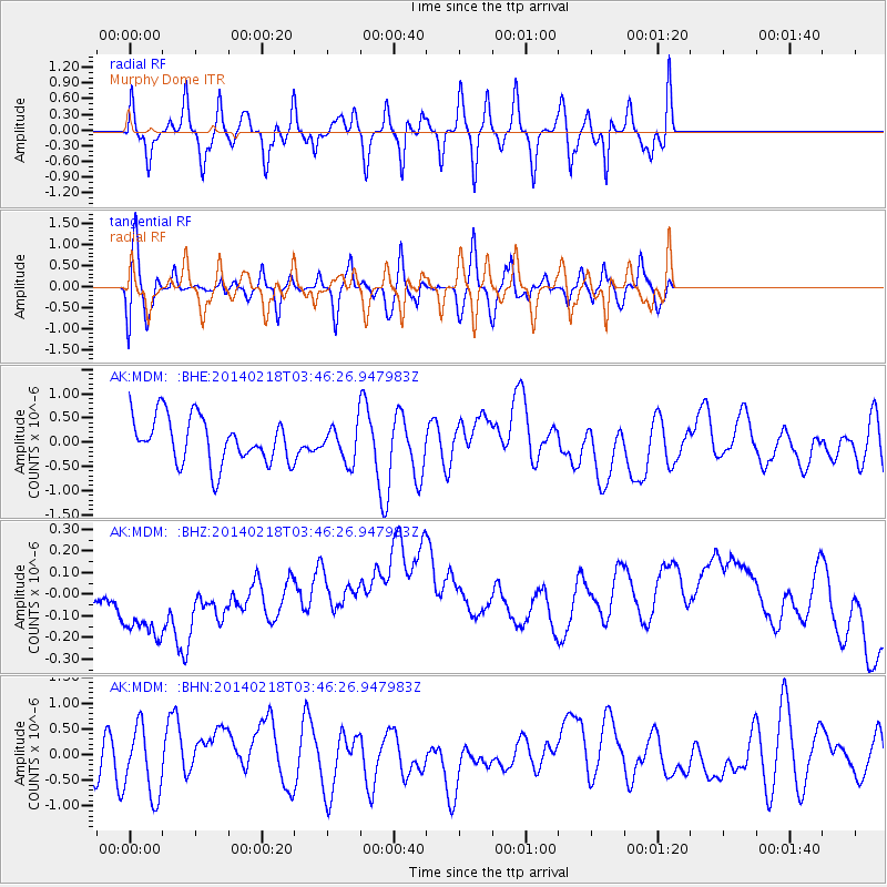
Signal To Noise
| Channel | StoN | STA | LTA |
| AK:MDM: :BHZ:20140218T03:46:26.947983Z | 1.3394666 | 2.9460122E-7 | 2.1993922E-7 |
| AK:MDM: :BHN:20140218T03:46:26.947983Z | 1.9248954 | 6.5956146E-7 | 3.4264792E-7 |
| AK:MDM: :BHE:20140218T03:46:26.947983Z | 0.7769225 | 3.6933565E-7 | 4.7538288E-7 |
| Arrivals |
| Ps | |
| PpPs | |
| PsPs/PpSs | |


