You are here: Home > Network List > IC - New China Digital Seismograph Network Stations List
> Station WMQ Urumqi, Xinjiang Province, China > Earthquake Result Viewer
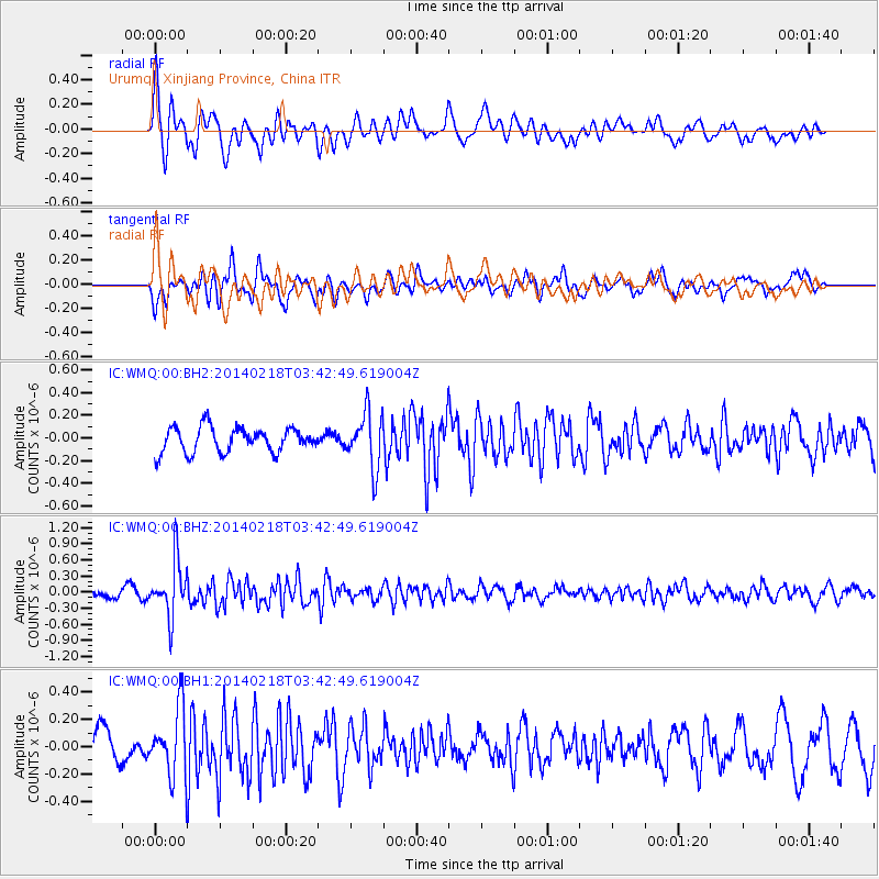
WMQ Urumqi, Xinjiang Province, China - Earthquake Result Viewer
*The percent match for this event was below the threshold and hence no stack was calculated.
| Earthquake location: |
Minahassa Peninsula, Sulawesi |
| Earthquake latitude/longitude: |
1.7/122.9 |
| Earthquake time(UTC): |
2014/02/18 (049) 03:34:12 GMT |
| Earthquake Depth: |
46 km |
| Earthquake Magnitude: |
5.3 MW |
| Earthquake Catalog/Contributor: |
ISC/ISC |
|
| Network: |
IC New China Digital Seismograph Network |
| Station: |
WMQ Urumqi, Xinjiang Province, China |
| Lat/Lon: |
43.81 N/87.70 E |
| Elevation: |
850 m |
|
| Distance: |
52.3 deg |
| Az: |
328.156 deg |
| Baz: |
133.237 deg |
| Ray Param: |
$rayparam |
*The percent match for this event was below the threshold and hence was not used in the summary stack. |
|
| Radial Match: |
62.979286 % |
| Radial Bump: |
400 |
| Transverse Match: |
55.85385 % |
| Transverse Bump: |
400 |
| SOD ConfigId: |
3390531 |
| Insert Time: |
2019-04-10 09:03:17.282 +0000 |
| GWidth: |
2.5 |
| Max Bumps: |
400 |
| Tol: |
0.001 |
|
Signal To Noise
| Channel | StoN | STA | LTA |
| IC:WMQ:00:BHZ:20140218T03:42:49.619004Z | 5.7159853 | 5.168356E-7 | 9.0419334E-8 |
| IC:WMQ:00:BH1:20140218T03:42:49.619004Z | 2.1736505 | 2.469622E-7 | 1.1361634E-7 |
| IC:WMQ:00:BH2:20140218T03:42:49.619004Z | 2.2261288 | 2.4453402E-7 | 1.0984721E-7 |
| Arrivals |
| Ps | |
| PpPs | |
| PsPs/PpSs | |


