You are here: Home > Network List > TA - USArray Transportable Network (new EarthScope stations) Stations List
> Station L02D Cave Junction, OR, USA > Earthquake Result Viewer
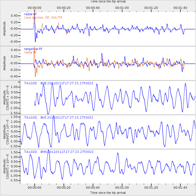
L02D Cave Junction, OR, USA - Earthquake Result Viewer
*The percent match for this event was below the threshold and hence no stack was calculated.
| Earthquake location: |
Off East Coast Of Honshu, Japan |
| Earthquake latitude/longitude: |
37.0/144.2 |
| Earthquake time(UTC): |
2011/03/11 (070) 17:16:56 GMT |
| Earthquake Depth: |
9.3 km |
| Earthquake Magnitude: |
5.5 MB, 5.6 MS |
| Earthquake Catalog/Contributor: |
WHDF/NEIC |
|
| Network: |
TA USArray Transportable Network (new EarthScope stations) |
| Station: |
L02D Cave Junction, OR, USA |
| Lat/Lon: |
42.16 N/123.60 W |
| Elevation: |
458 m |
|
| Distance: |
67.8 deg |
| Az: |
53.352 deg |
| Baz: |
300.246 deg |
| Ray Param: |
$rayparam |
*The percent match for this event was below the threshold and hence was not used in the summary stack. |
|
| Radial Match: |
47.73996 % |
| Radial Bump: |
314 |
| Transverse Match: |
55.37767 % |
| Transverse Bump: |
380 |
| SOD ConfigId: |
356183 |
| Insert Time: |
2011-08-17 14:29:17.207 +0000 |
| GWidth: |
2.5 |
| Max Bumps: |
400 |
| Tol: |
0.001 |
|
Signal To Noise
| Channel | StoN | STA | LTA |
| TA:L02D: :BHZ:20110311T17:27:23.275002Z | 1.0343485 | 8.4415586E-7 | 8.1612325E-7 |
| TA:L02D: :BHN:20110311T17:27:23.275002Z | 1.4414777 | 8.080427E-7 | 5.605655E-7 |
| TA:L02D: :BHE:20110311T17:27:23.275002Z | 0.31164393 | 2.1719899E-7 | 6.9694596E-7 |
| Arrivals |
| Ps | |
| PpPs | |
| PsPs/PpSs | |


