You are here: Home > Network List > IU - Global Seismograph Network (GSN - IRIS/USGS) Stations List
> Station MAKZ Makanchi, Kazakhstan > Earthquake Result Viewer
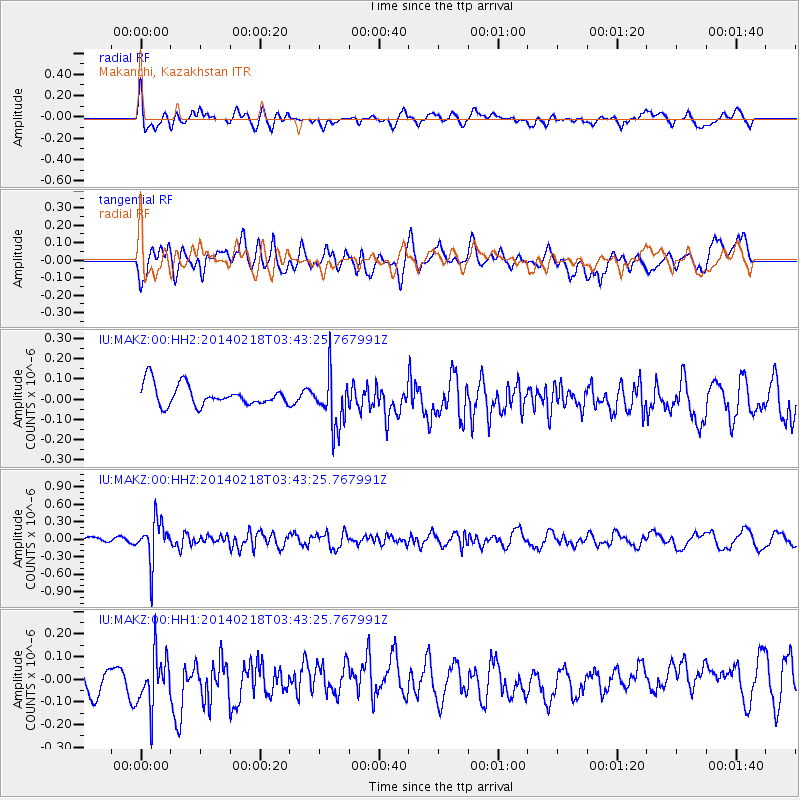
MAKZ Makanchi, Kazakhstan - Earthquake Result Viewer
*The percent match for this event was below the threshold and hence no stack was calculated.
| Earthquake location: |
Minahassa Peninsula, Sulawesi |
| Earthquake latitude/longitude: |
1.7/122.9 |
| Earthquake time(UTC): |
2014/02/18 (049) 03:34:12 GMT |
| Earthquake Depth: |
46 km |
| Earthquake Magnitude: |
5.3 MW |
| Earthquake Catalog/Contributor: |
ISC/ISC |
|
| Network: |
IU Global Seismograph Network (GSN - IRIS/USGS) |
| Station: |
MAKZ Makanchi, Kazakhstan |
| Lat/Lon: |
46.81 N/81.98 E |
| Elevation: |
600 m |
|
| Distance: |
57.4 deg |
| Az: |
327.667 deg |
| Baz: |
128.894 deg |
| Ray Param: |
$rayparam |
*The percent match for this event was below the threshold and hence was not used in the summary stack. |
|
| Radial Match: |
65.74076 % |
| Radial Bump: |
400 |
| Transverse Match: |
58.028805 % |
| Transverse Bump: |
400 |
| SOD ConfigId: |
3390531 |
| Insert Time: |
2019-04-10 09:03:29.659 +0000 |
| GWidth: |
2.5 |
| Max Bumps: |
400 |
| Tol: |
0.001 |
|
Signal To Noise
| Channel | StoN | STA | LTA |
| IU:MAKZ:00:HHZ:20140218T03:43:25.767991Z | 7.253729 | 3.5124057E-7 | 4.842207E-8 |
| IU:MAKZ:00:HH1:20140218T03:43:25.767991Z | 2.641908 | 1.1925735E-7 | 4.5140617E-8 |
| IU:MAKZ:00:HH2:20140218T03:43:25.767991Z | 2.4956245 | 1.2892883E-7 | 5.1661946E-8 |
| Arrivals |
| Ps | |
| PpPs | |
| PsPs/PpSs | |


