You are here: Home > Network List > TA - USArray Transportable Network (new EarthScope stations) Stations List
> Station 934A Benavides, TX, USA > Earthquake Result Viewer
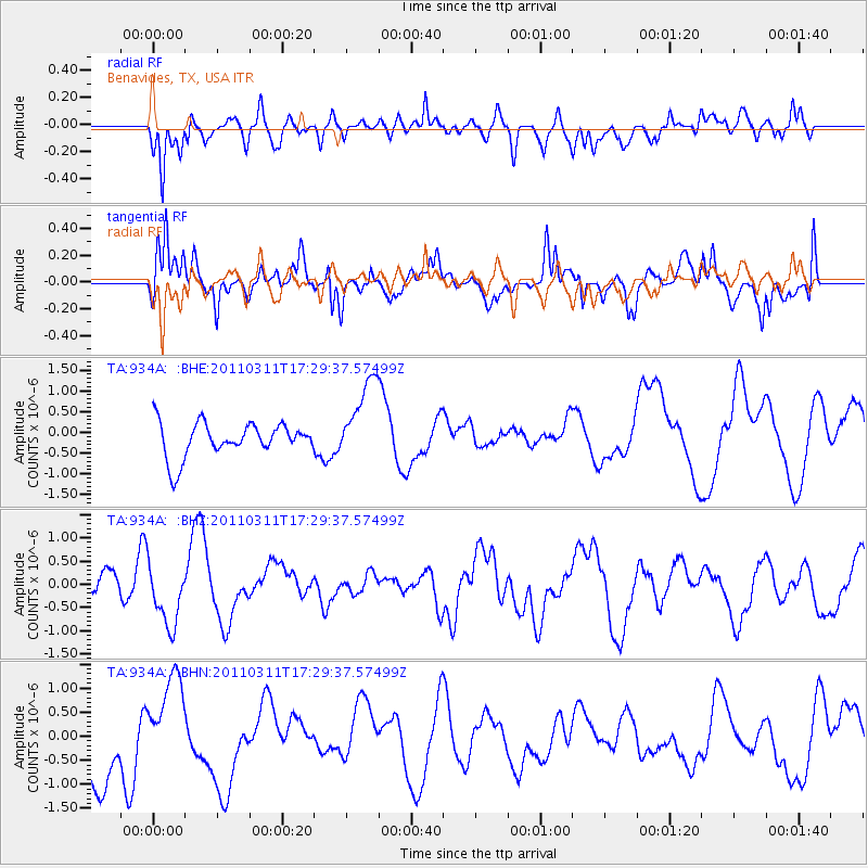
934A Benavides, TX, USA - Earthquake Result Viewer
*The percent match for this event was below the threshold and hence no stack was calculated.
| Earthquake location: |
Off East Coast Of Honshu, Japan |
| Earthquake latitude/longitude: |
37.0/144.2 |
| Earthquake time(UTC): |
2011/03/11 (070) 17:16:56 GMT |
| Earthquake Depth: |
9.3 km |
| Earthquake Magnitude: |
5.5 MB, 5.6 MS |
| Earthquake Catalog/Contributor: |
WHDF/NEIC |
|
| Network: |
TA USArray Transportable Network (new EarthScope stations) |
| Station: |
934A Benavides, TX, USA |
| Lat/Lon: |
27.60 N/98.52 W |
| Elevation: |
144 m |
|
| Distance: |
92.9 deg |
| Az: |
52.133 deg |
| Baz: |
314.589 deg |
| Ray Param: |
$rayparam |
*The percent match for this event was below the threshold and hence was not used in the summary stack. |
|
| Radial Match: |
57.64208 % |
| Radial Bump: |
400 |
| Transverse Match: |
60.952744 % |
| Transverse Bump: |
400 |
| SOD ConfigId: |
356183 |
| Insert Time: |
2011-08-17 14:33:14.690 +0000 |
| GWidth: |
2.5 |
| Max Bumps: |
400 |
| Tol: |
0.001 |
|
Signal To Noise
| Channel | StoN | STA | LTA |
| TA:934A: :BHZ:20110311T17:29:37.57499Z | 1.4738187 | 6.5751505E-7 | 4.4613026E-7 |
| TA:934A: :BHN:20110311T17:29:37.57499Z | 1.184406 | 8.4032587E-7 | 7.0949136E-7 |
| TA:934A: :BHE:20110311T17:29:37.57499Z | 2.4542928 | 1.0135788E-6 | 4.12982E-7 |
| Arrivals |
| Ps | |
| PpPs | |
| PsPs/PpSs | |


