You are here: Home > Network List > TA - USArray Transportable Network (new EarthScope stations) Stations List
> Station 933A Laredo, TX, USA > Earthquake Result Viewer
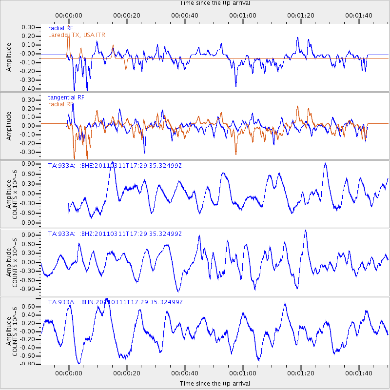
933A Laredo, TX, USA - Earthquake Result Viewer
*The percent match for this event was below the threshold and hence no stack was calculated.
| Earthquake location: |
Off East Coast Of Honshu, Japan |
| Earthquake latitude/longitude: |
37.0/144.2 |
| Earthquake time(UTC): |
2011/03/11 (070) 17:16:56 GMT |
| Earthquake Depth: |
9.3 km |
| Earthquake Magnitude: |
5.5 MB, 5.6 MS |
| Earthquake Catalog/Contributor: |
WHDF/NEIC |
|
| Network: |
TA USArray Transportable Network (new EarthScope stations) |
| Station: |
933A Laredo, TX, USA |
| Lat/Lon: |
27.61 N/99.27 W |
| Elevation: |
214 m |
|
| Distance: |
92.4 deg |
| Az: |
52.595 deg |
| Baz: |
314.22 deg |
| Ray Param: |
$rayparam |
*The percent match for this event was below the threshold and hence was not used in the summary stack. |
|
| Radial Match: |
50.83506 % |
| Radial Bump: |
370 |
| Transverse Match: |
56.20018 % |
| Transverse Bump: |
367 |
| SOD ConfigId: |
356183 |
| Insert Time: |
2011-08-17 14:33:30.151 +0000 |
| GWidth: |
2.5 |
| Max Bumps: |
400 |
| Tol: |
0.001 |
|
Signal To Noise
| Channel | StoN | STA | LTA |
| TA:933A: :BHZ:20110311T17:29:35.32499Z | 0.76233304 | 3.0108114E-7 | 3.94947E-7 |
| TA:933A: :BHN:20110311T17:29:35.32499Z | 1.3959574 | 5.84288E-7 | 4.1855722E-7 |
| TA:933A: :BHE:20110311T17:29:35.32499Z | 0.55811393 | 2.269288E-7 | 4.0659944E-7 |
| Arrivals |
| Ps | |
| PpPs | |
| PsPs/PpSs | |


