You are here: Home > Network List > TA - USArray Transportable Network (new EarthScope stations) Stations List
> Station T36A Boggs Farm, Caney, KS, USA > Earthquake Result Viewer
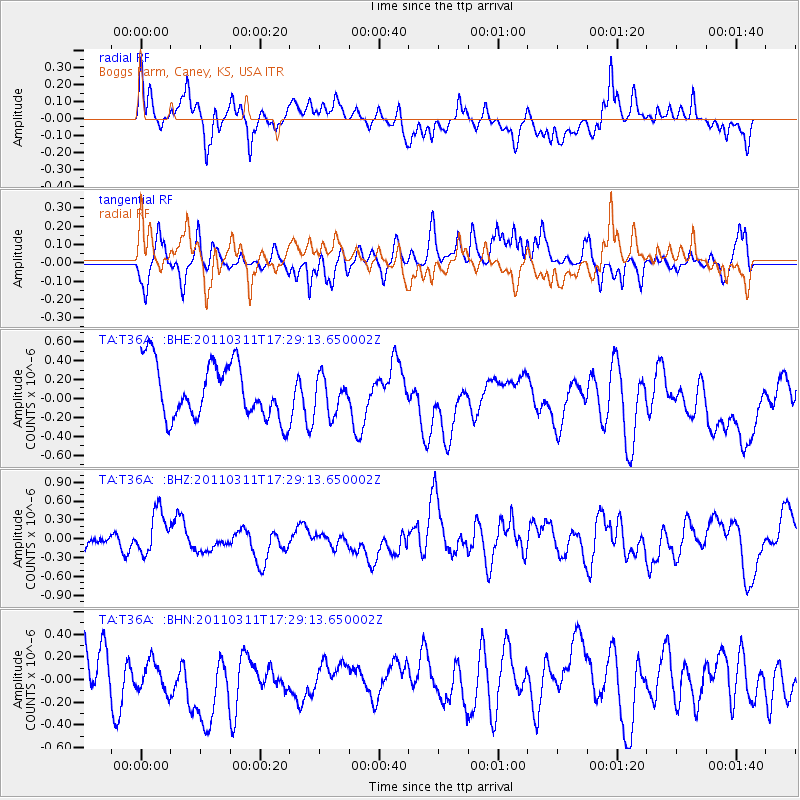
T36A Boggs Farm, Caney, KS, USA - Earthquake Result Viewer
*The percent match for this event was below the threshold and hence no stack was calculated.
| Earthquake location: |
Off East Coast Of Honshu, Japan |
| Earthquake latitude/longitude: |
37.0/144.2 |
| Earthquake time(UTC): |
2011/03/11 (070) 17:16:56 GMT |
| Earthquake Depth: |
9.3 km |
| Earthquake Magnitude: |
5.5 MB, 5.6 MS |
| Earthquake Catalog/Contributor: |
WHDF/NEIC |
|
| Network: |
TA USArray Transportable Network (new EarthScope stations) |
| Station: |
T36A Boggs Farm, Caney, KS, USA |
| Lat/Lon: |
37.06 N/95.88 W |
| Elevation: |
243 m |
|
| Distance: |
87.7 deg |
| Az: |
43.914 deg |
| Baz: |
316.041 deg |
| Ray Param: |
$rayparam |
*The percent match for this event was below the threshold and hence was not used in the summary stack. |
|
| Radial Match: |
53.161575 % |
| Radial Bump: |
400 |
| Transverse Match: |
56.86352 % |
| Transverse Bump: |
400 |
| SOD ConfigId: |
356183 |
| Insert Time: |
2011-08-17 14:37:49.764 +0000 |
| GWidth: |
2.5 |
| Max Bumps: |
400 |
| Tol: |
0.001 |
|
Signal To Noise
| Channel | StoN | STA | LTA |
| TA:T36A: :BHZ:20110311T17:29:13.650002Z | 1.5759642 | 3.5119234E-7 | 2.2284283E-7 |
| TA:T36A: :BHN:20110311T17:29:13.650002Z | 0.8197913 | 1.5485807E-7 | 1.8889938E-7 |
| TA:T36A: :BHE:20110311T17:29:13.650002Z | 0.65939105 | 1.9177708E-7 | 2.9083967E-7 |
| Arrivals |
| Ps | |
| PpPs | |
| PsPs/PpSs | |


