You are here: Home > Network List > KN - Kyrgyz Seismic Telemetry Network Stations List
> Station CHM KN.CHM > Earthquake Result Viewer
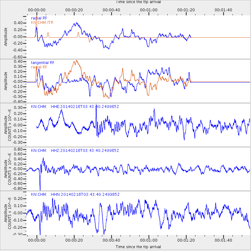
CHM KN.CHM - Earthquake Result Viewer
*The percent match for this event was below the threshold and hence no stack was calculated.
| Earthquake location: |
Minahassa Peninsula, Sulawesi |
| Earthquake latitude/longitude: |
1.7/122.9 |
| Earthquake time(UTC): |
2014/02/18 (049) 03:34:12 GMT |
| Earthquake Depth: |
46 km |
| Earthquake Magnitude: |
5.3 MW |
| Earthquake Catalog/Contributor: |
ISC/ISC |
|
| Network: |
KN Kyrgyz Seismic Telemetry Network |
| Station: |
CHM KN.CHM |
| Lat/Lon: |
43.00 N/74.75 E |
| Elevation: |
655 m |
|
| Distance: |
59.4 deg |
| Az: |
320.573 deg |
| Baz: |
120.082 deg |
| Ray Param: |
$rayparam |
*The percent match for this event was below the threshold and hence was not used in the summary stack. |
|
| Radial Match: |
43.54208 % |
| Radial Bump: |
400 |
| Transverse Match: |
39.944843 % |
| Transverse Bump: |
400 |
| SOD ConfigId: |
3390531 |
| Insert Time: |
2019-04-10 09:03:42.826 +0000 |
| GWidth: |
2.5 |
| Max Bumps: |
400 |
| Tol: |
0.001 |
|
Signal To Noise
| Channel | StoN | STA | LTA |
| KN:CHM: :HHZ:20140218T03:43:40.249985Z | 5.547375 | 2.5732842E-7 | 4.6387417E-8 |
| KN:CHM: :HHN:20140218T03:43:40.249985Z | 0.932808 | 1.0793644E-7 | 1.1571131E-7 |
| KN:CHM: :HHE:20140218T03:43:40.249985Z | 1.2407273 | 1.121128E-7 | 9.036055E-8 |
| Arrivals |
| Ps | |
| PpPs | |
| PsPs/PpSs | |


