You are here: Home > Network List > TA - USArray Transportable Network (new EarthScope stations) Stations List
> Station 136A Ennis, TX, USA > Earthquake Result Viewer
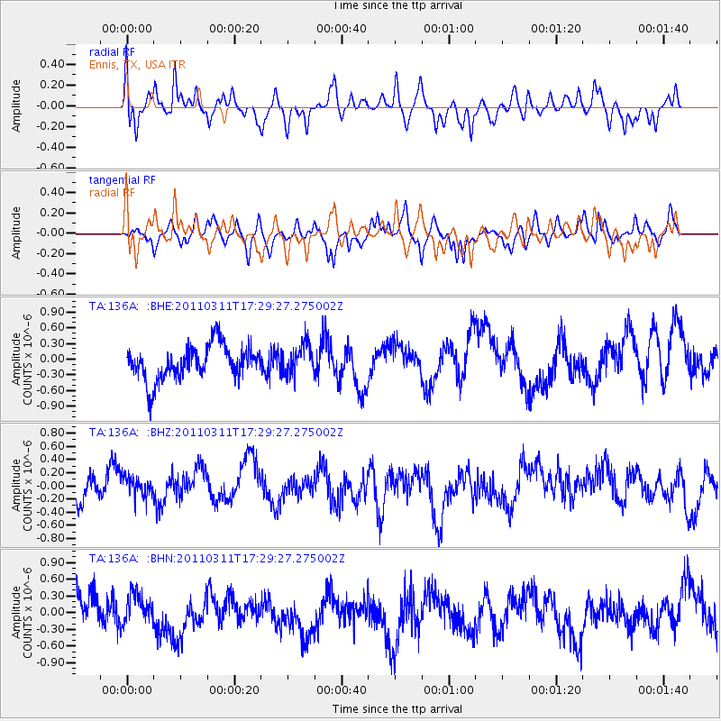
136A Ennis, TX, USA - Earthquake Result Viewer
*The percent match for this event was below the threshold and hence no stack was calculated.
| Earthquake location: |
Off East Coast Of Honshu, Japan |
| Earthquake latitude/longitude: |
37.0/144.2 |
| Earthquake time(UTC): |
2011/03/11 (070) 17:16:56 GMT |
| Earthquake Depth: |
9.3 km |
| Earthquake Magnitude: |
5.5 MB, 5.6 MS |
| Earthquake Catalog/Contributor: |
WHDF/NEIC |
|
| Network: |
TA USArray Transportable Network (new EarthScope stations) |
| Station: |
136A Ennis, TX, USA |
| Lat/Lon: |
32.47 N/96.53 W |
| Elevation: |
113 m |
|
| Distance: |
90.6 deg |
| Az: |
47.484 deg |
| Baz: |
315.723 deg |
| Ray Param: |
$rayparam |
*The percent match for this event was below the threshold and hence was not used in the summary stack. |
|
| Radial Match: |
56.031506 % |
| Radial Bump: |
400 |
| Transverse Match: |
51.764954 % |
| Transverse Bump: |
368 |
| SOD ConfigId: |
356183 |
| Insert Time: |
2011-08-17 14:39:29.167 +0000 |
| GWidth: |
2.5 |
| Max Bumps: |
400 |
| Tol: |
0.001 |
|
Signal To Noise
| Channel | StoN | STA | LTA |
| TA:136A: :BHZ:20110311T17:29:27.275002Z | 0.808946 | 2.1035846E-7 | 2.6004017E-7 |
| TA:136A: :BHN:20110311T17:29:27.275002Z | 0.6964261 | 2.866836E-7 | 4.116497E-7 |
| TA:136A: :BHE:20110311T17:29:27.275002Z | 0.88483715 | 2.869245E-7 | 3.2426814E-7 |
| Arrivals |
| Ps | |
| PpPs | |
| PsPs/PpSs | |


