You are here: Home > Network List > TA - USArray Transportable Network (new EarthScope stations) Stations List
> Station G35A Watkins, MN, USA > Earthquake Result Viewer
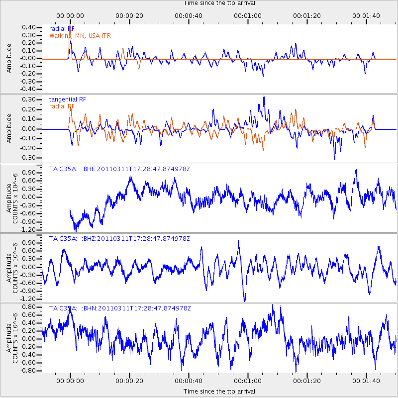
G35A Watkins, MN, USA - Earthquake Result Viewer
*The percent match for this event was below the threshold and hence no stack was calculated.
| Earthquake location: |
Off East Coast Of Honshu, Japan |
| Earthquake latitude/longitude: |
37.0/144.2 |
| Earthquake time(UTC): |
2011/03/11 (070) 17:16:56 GMT |
| Earthquake Depth: |
9.3 km |
| Earthquake Magnitude: |
5.5 MB, 5.6 MS |
| Earthquake Catalog/Contributor: |
WHDF/NEIC |
|
| Network: |
TA USArray Transportable Network (new EarthScope stations) |
| Station: |
G35A Watkins, MN, USA |
| Lat/Lon: |
45.22 N/94.49 W |
| Elevation: |
361 m |
|
| Distance: |
82.6 deg |
| Az: |
37.494 deg |
| Baz: |
316.412 deg |
| Ray Param: |
$rayparam |
*The percent match for this event was below the threshold and hence was not used in the summary stack. |
|
| Radial Match: |
51.097107 % |
| Radial Bump: |
318 |
| Transverse Match: |
60.684532 % |
| Transverse Bump: |
261 |
| SOD ConfigId: |
356183 |
| Insert Time: |
2011-08-17 14:52:33.661 +0000 |
| GWidth: |
2.5 |
| Max Bumps: |
400 |
| Tol: |
0.001 |
|
Signal To Noise
| Channel | StoN | STA | LTA |
| TA:G35A: :BHZ:20110311T17:28:47.874978Z | 0.8642783 | 3.002731E-7 | 3.4742638E-7 |
| TA:G35A: :BHN:20110311T17:28:47.874978Z | 1.4741005 | 5.8525256E-7 | 3.970235E-7 |
| TA:G35A: :BHE:20110311T17:28:47.874978Z | 1.21488 | 6.189982E-7 | 5.095139E-7 |
| Arrivals |
| Ps | |
| PpPs | |
| PsPs/PpSs | |


