You are here: Home > Network List > TA - USArray Transportable Network (new EarthScope stations) Stations List
> Station POKR Poker Plat Research Range, AK, USA > Earthquake Result Viewer
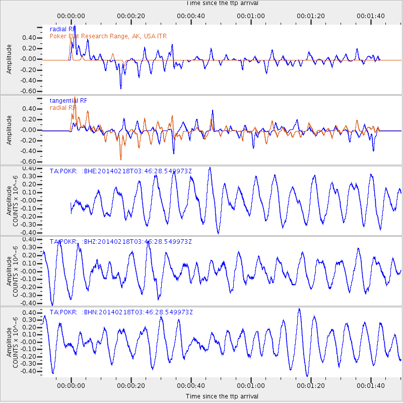
POKR Poker Plat Research Range, AK, USA - Earthquake Result Viewer
*The percent match for this event was below the threshold and hence no stack was calculated.
| Earthquake location: |
Minahassa Peninsula, Sulawesi |
| Earthquake latitude/longitude: |
1.7/122.9 |
| Earthquake time(UTC): |
2014/02/18 (049) 03:34:12 GMT |
| Earthquake Depth: |
46 km |
| Earthquake Magnitude: |
5.3 MW |
| Earthquake Catalog/Contributor: |
ISC/ISC |
|
| Network: |
TA USArray Transportable Network (new EarthScope stations) |
| Station: |
POKR Poker Plat Research Range, AK, USA |
| Lat/Lon: |
65.12 N/147.43 W |
| Elevation: |
501 m |
|
| Distance: |
88.3 deg |
| Az: |
25.041 deg |
| Baz: |
270.359 deg |
| Ray Param: |
$rayparam |
*The percent match for this event was below the threshold and hence was not used in the summary stack. |
|
| Radial Match: |
58.835835 % |
| Radial Bump: |
400 |
| Transverse Match: |
44.134457 % |
| Transverse Bump: |
294 |
| SOD ConfigId: |
3390531 |
| Insert Time: |
2019-04-10 09:04:26.369 +0000 |
| GWidth: |
2.5 |
| Max Bumps: |
400 |
| Tol: |
0.001 |
|
Signal To Noise
| Channel | StoN | STA | LTA |
| TA:POKR: :BHZ:20140218T03:46:28.549973Z | 1.8209655 | 2.340483E-7 | 1.2852978E-7 |
| TA:POKR: :BHN:20140218T03:46:28.549973Z | 0.36967283 | 7.9965076E-8 | 2.1631308E-7 |
| TA:POKR: :BHE:20140218T03:46:28.549973Z | 1.8270645 | 2.1838683E-7 | 1.195288E-7 |
| Arrivals |
| Ps | |
| PpPs | |
| PsPs/PpSs | |


