You are here: Home > Network List > CI - Caltech Regional Seismic Network Stations List
> Station FUR Furnace Creek, CA, USA > Earthquake Result Viewer
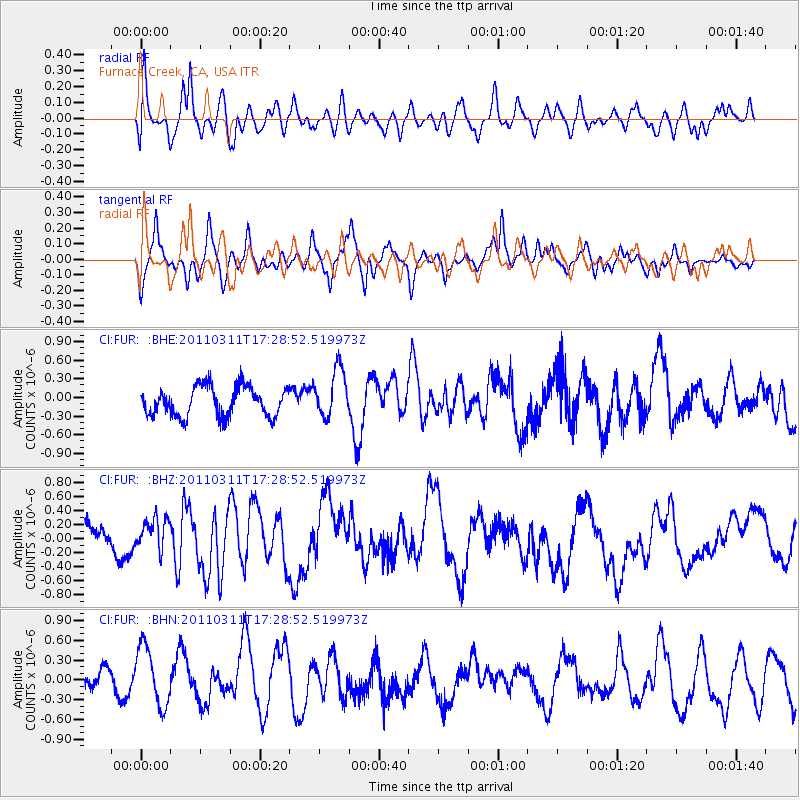
FUR Furnace Creek, CA, USA - Earthquake Result Viewer
*The percent match for this event was below the threshold and hence no stack was calculated.
| Earthquake location: |
Near East Coast Of Honshu, Japan |
| Earthquake latitude/longitude: |
35.3/141.4 |
| Earthquake time(UTC): |
2011/03/11 (070) 17:17:23 GMT |
| Earthquake Depth: |
1.7 km |
| Earthquake Magnitude: |
5.5 MB |
| Earthquake Catalog/Contributor: |
WHDF/NEIC |
|
| Network: |
CI Caltech Regional Seismic Network |
| Station: |
FUR Furnace Creek, CA, USA |
| Lat/Lon: |
36.47 N/116.86 W |
| Elevation: |
-37.0 m |
|
| Distance: |
78.1 deg |
| Az: |
53.766 deg |
| Baz: |
305.098 deg |
| Ray Param: |
$rayparam |
*The percent match for this event was below the threshold and hence was not used in the summary stack. |
|
| Radial Match: |
52.437454 % |
| Radial Bump: |
400 |
| Transverse Match: |
66.37658 % |
| Transverse Bump: |
400 |
| SOD ConfigId: |
356183 |
| Insert Time: |
2011-08-17 15:50:45.117 +0000 |
| GWidth: |
2.5 |
| Max Bumps: |
400 |
| Tol: |
0.001 |
|
Signal To Noise
| Channel | StoN | STA | LTA |
| CI:FUR: :BHZ:20110311T17:28:52.519973Z | 0.8609425 | 2.0883928E-7 | 2.4257054E-7 |
| CI:FUR: :BHN:20110311T17:28:52.519973Z | 1.2955247 | 4.9723155E-7 | 3.8380708E-7 |
| CI:FUR: :BHE:20110311T17:28:52.519973Z | 1.6467304 | 3.8897883E-7 | 2.3621281E-7 |
| Arrivals |
| Ps | |
| PpPs | |
| PsPs/PpSs | |


