You are here: Home > Network List > IW - Intermountain West Stations List
> Station MOOW Moose Ponds, Wyoming, USA > Earthquake Result Viewer
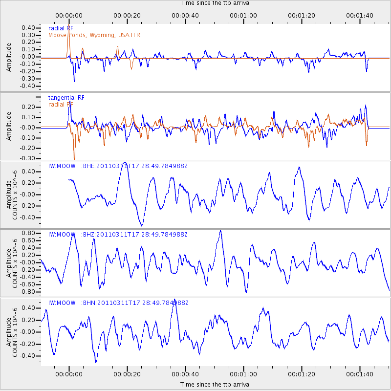
MOOW Moose Ponds, Wyoming, USA - Earthquake Result Viewer
*The percent match for this event was below the threshold and hence no stack was calculated.
| Earthquake location: |
Near East Coast Of Honshu, Japan |
| Earthquake latitude/longitude: |
35.3/141.4 |
| Earthquake time(UTC): |
2011/03/11 (070) 17:17:23 GMT |
| Earthquake Depth: |
1.7 km |
| Earthquake Magnitude: |
5.5 MB |
| Earthquake Catalog/Contributor: |
WHDF/NEIC |
|
| Network: |
IW Intermountain West |
| Station: |
MOOW Moose Ponds, Wyoming, USA |
| Lat/Lon: |
43.75 N/110.74 W |
| Elevation: |
2128 m |
|
| Distance: |
77.6 deg |
| Az: |
44.932 deg |
| Baz: |
307.169 deg |
| Ray Param: |
$rayparam |
*The percent match for this event was below the threshold and hence was not used in the summary stack. |
|
| Radial Match: |
56.59183 % |
| Radial Bump: |
361 |
| Transverse Match: |
60.18859 % |
| Transverse Bump: |
400 |
| SOD ConfigId: |
356183 |
| Insert Time: |
2011-08-17 16:11:03.906 +0000 |
| GWidth: |
2.5 |
| Max Bumps: |
400 |
| Tol: |
0.001 |
|
Signal To Noise
| Channel | StoN | STA | LTA |
| IW:MOOW: :BHZ:20110311T17:28:49.784988Z | 4.3134165 | 4.913205E-7 | 1.1390519E-7 |
| IW:MOOW: :BHN:20110311T17:28:49.784988Z | 0.35999763 | 8.36477E-8 | 2.3235624E-7 |
| IW:MOOW: :BHE:20110311T17:28:49.784988Z | 0.7365917 | 1.7745603E-7 | 2.4091506E-7 |
| Arrivals |
| Ps | |
| PpPs | |
| PsPs/PpSs | |


