You are here: Home > Network List > TA - USArray Transportable Network (new EarthScope stations) Stations List
> Station Q24A Divide, CO, USA > Earthquake Result Viewer
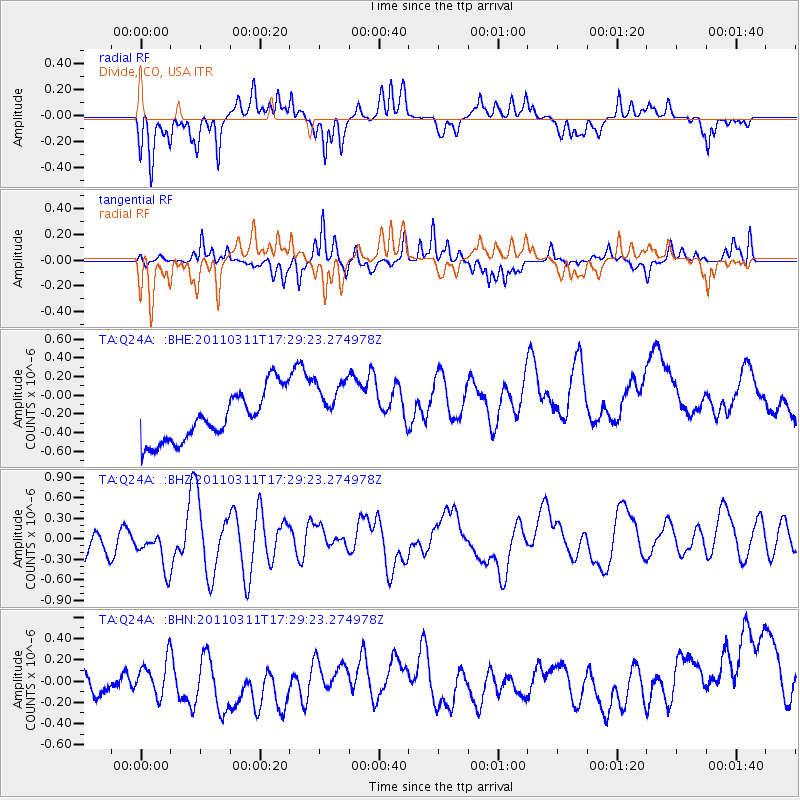
Q24A Divide, CO, USA - Earthquake Result Viewer
*The percent match for this event was below the threshold and hence no stack was calculated.
| Earthquake location: |
Near East Coast Of Honshu, Japan |
| Earthquake latitude/longitude: |
35.3/141.4 |
| Earthquake time(UTC): |
2011/03/11 (070) 17:17:23 GMT |
| Earthquake Depth: |
1.7 km |
| Earthquake Magnitude: |
5.5 MB |
| Earthquake Catalog/Contributor: |
WHDF/NEIC |
|
| Network: |
TA USArray Transportable Network (new EarthScope stations) |
| Station: |
Q24A Divide, CO, USA |
| Lat/Lon: |
38.96 N/105.15 W |
| Elevation: |
2775 m |
|
| Distance: |
83.9 deg |
| Az: |
45.994 deg |
| Baz: |
311.029 deg |
| Ray Param: |
$rayparam |
*The percent match for this event was below the threshold and hence was not used in the summary stack. |
|
| Radial Match: |
65.98961 % |
| Radial Bump: |
297 |
| Transverse Match: |
62.921833 % |
| Transverse Bump: |
314 |
| SOD ConfigId: |
356183 |
| Insert Time: |
2011-08-17 16:27:56.243 +0000 |
| GWidth: |
2.5 |
| Max Bumps: |
400 |
| Tol: |
0.001 |
|
Signal To Noise
| Channel | StoN | STA | LTA |
| TA:Q24A: :BHZ:20110311T17:29:23.274978Z | 1.4167432 | 3.478937E-7 | 2.4555877E-7 |
| TA:Q24A: :BHN:20110311T17:29:23.274978Z | 0.6619305 | 1.7134859E-7 | 2.588619E-7 |
| TA:Q24A: :BHE:20110311T17:29:23.274978Z | 1.16108 | 3.1085577E-7 | 2.6772983E-7 |
| Arrivals |
| Ps | |
| PpPs | |
| PsPs/PpSs | |


