You are here: Home > Network List > TA - USArray Transportable Network (new EarthScope stations) Stations List
> Station P29A Atwood, KS, USA > Earthquake Result Viewer
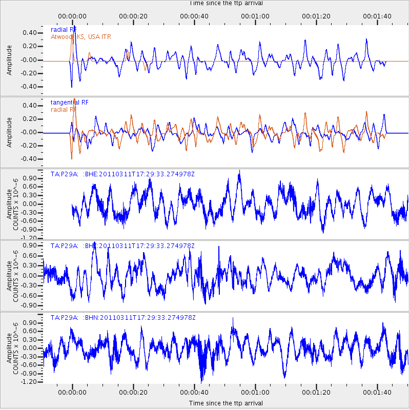
P29A Atwood, KS, USA - Earthquake Result Viewer
*The percent match for this event was below the threshold and hence no stack was calculated.
| Earthquake location: |
Near East Coast Of Honshu, Japan |
| Earthquake latitude/longitude: |
35.3/141.4 |
| Earthquake time(UTC): |
2011/03/11 (070) 17:17:23 GMT |
| Earthquake Depth: |
1.7 km |
| Earthquake Magnitude: |
5.5 MB |
| Earthquake Catalog/Contributor: |
WHDF/NEIC |
|
| Network: |
TA USArray Transportable Network (new EarthScope stations) |
| Station: |
P29A Atwood, KS, USA |
| Lat/Lon: |
39.60 N/100.93 W |
| Elevation: |
929 m |
|
| Distance: |
85.9 deg |
| Az: |
43.312 deg |
| Baz: |
313.449 deg |
| Ray Param: |
$rayparam |
*The percent match for this event was below the threshold and hence was not used in the summary stack. |
|
| Radial Match: |
49.534447 % |
| Radial Bump: |
400 |
| Transverse Match: |
53.289307 % |
| Transverse Bump: |
400 |
| SOD ConfigId: |
356183 |
| Insert Time: |
2011-08-17 16:33:37.306 +0000 |
| GWidth: |
2.5 |
| Max Bumps: |
400 |
| Tol: |
0.001 |
|
Signal To Noise
| Channel | StoN | STA | LTA |
| TA:P29A: :BHZ:20110311T17:29:33.274978Z | 1.331875 | 5.2353164E-7 | 3.930787E-7 |
| TA:P29A: :BHN:20110311T17:29:33.274978Z | 0.89723027 | 3.2316495E-7 | 3.6018062E-7 |
| TA:P29A: :BHE:20110311T17:29:33.274978Z | 1.1171849 | 4.115882E-7 | 3.684155E-7 |
| Arrivals |
| Ps | |
| PpPs | |
| PsPs/PpSs | |


