You are here: Home > Network List > G - GEOSCOPE Stations List
> Station MBO M'Bour, Senegal > Earthquake Result Viewer
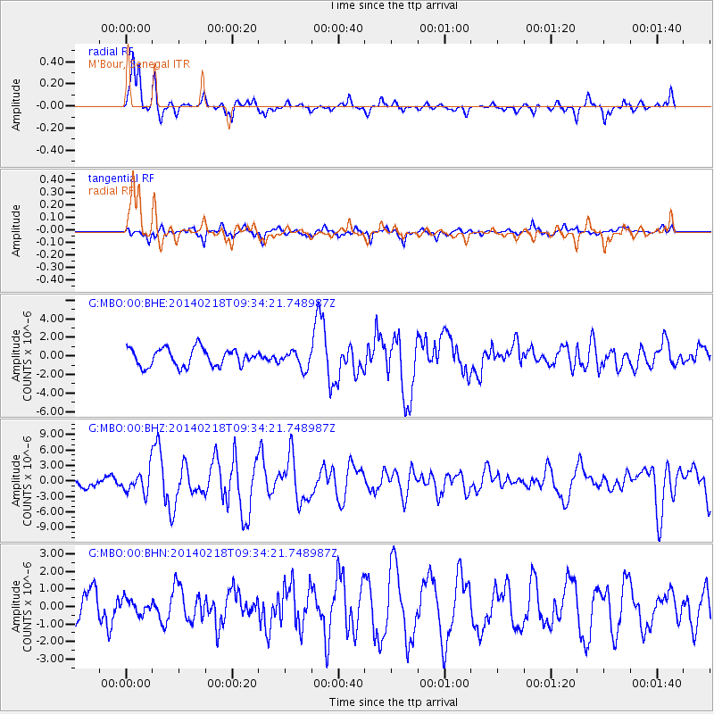
MBO M'Bour, Senegal - Earthquake Result Viewer
*The percent match for this event was below the threshold and hence no stack was calculated.
| Earthquake location: |
North Atlantic Ocean |
| Earthquake latitude/longitude: |
14.7/-58.9 |
| Earthquake time(UTC): |
2014/02/18 (049) 09:27:13 GMT |
| Earthquake Depth: |
17 km |
| Earthquake Magnitude: |
6.5 MWW, 6.3 MWB, 6.5 MWC, 6.6 MWC, 6.7 MI |
| Earthquake Catalog/Contributor: |
NEIC PDE/NEIC COMCAT |
|
| Network: |
G GEOSCOPE |
| Station: |
MBO M'Bour, Senegal |
| Lat/Lon: |
14.39 N/16.95 W |
| Elevation: |
3.0 m |
|
| Distance: |
40.6 deg |
| Az: |
84.888 deg |
| Baz: |
275.807 deg |
| Ray Param: |
$rayparam |
*The percent match for this event was below the threshold and hence was not used in the summary stack. |
|
| Radial Match: |
85.30903 % |
| Radial Bump: |
368 |
| Transverse Match: |
69.39606 % |
| Transverse Bump: |
400 |
| SOD ConfigId: |
3390531 |
| Insert Time: |
2019-04-10 09:11:09.035 +0000 |
| GWidth: |
2.5 |
| Max Bumps: |
400 |
| Tol: |
0.001 |
|
Signal To Noise
| Channel | StoN | STA | LTA |
| G:MBO:00:BHZ:20140218T09:34:21.748987Z | 1.6767702 | 2.3496143E-6 | 1.4012738E-6 |
| G:MBO:00:BHN:20140218T09:34:21.748987Z | 0.36538136 | 4.0021078E-7 | 1.0953235E-6 |
| G:MBO:00:BHE:20140218T09:34:21.748987Z | 0.98736507 | 9.42086E-7 | 9.541415E-7 |
| Arrivals |
| Ps | |
| PpPs | |
| PsPs/PpSs | |


