DEC06 Boomer - Earthquake Result Viewer
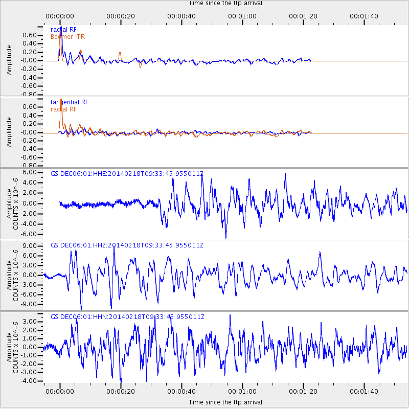
Earthquake location: North Atlantic Ocean
Earthquake latitude/longitude: 14.7/-58.9
Earthquake time(UTC): 2014/02/18 (049) 09:27:13 GMT
Earthquake Depth: 17 km
Earthquake Magnitude: 6.5 MWW, 6.3 MWB, 6.5 MWC, 6.6 MWC, 6.7 MI
Earthquake Catalog/Contributor: NEIC PDE/NEIC COMCAT
Network: GS US Geological Survey Networks
Station: DEC06 Boomer
Lat/Lon: 39.90 N/88.95 W
Elevation: 215 m
Distance: 36.4 deg
Az: 319.521 deg
Baz: 125.24 deg
Ray Param: 0.07670749
Estimated Moho Depth: 55.75 km
Estimated Crust Vp/Vs: 2.07
Assumed Crust Vp: 6.444 km/s
Estimated Crust Vs: 3.117 km/s
Estimated Crust Poisson's Ratio: 0.35
Radial Match: 93.06112 %
Radial Bump: 341
Transverse Match: 77.22341 %
Transverse Bump: 400
SOD ConfigId: 3390531
Insert Time: 2019-04-10 09:11:23.829 +0000
GWidth: 2.5
Max Bumps: 400
Tol: 0.001

Signal To Noise

ChannelStoNSTALTA
GS:DEC06:01:HHZ:20140218T09:33:45.955011Z6.8499462.765515E-64.0372802E-7
GS:DEC06:01:HHN:20140218T09:33:45.955011Z2.58843339.5256416E-73.68008E-7
GS:DEC06:01:HHE:20140218T09:33:45.955011Z4.0099711.3506259E-63.3681687E-7
Arrivals
Ps9.8 SECOND
PpPs25 SECOND
PsPs/PpSs35 SECOND