You are here: Home > Network List > US - United States National Seismic Network Stations List
> Station MIAR Mount Ida, Arkansas, USA > Earthquake Result Viewer
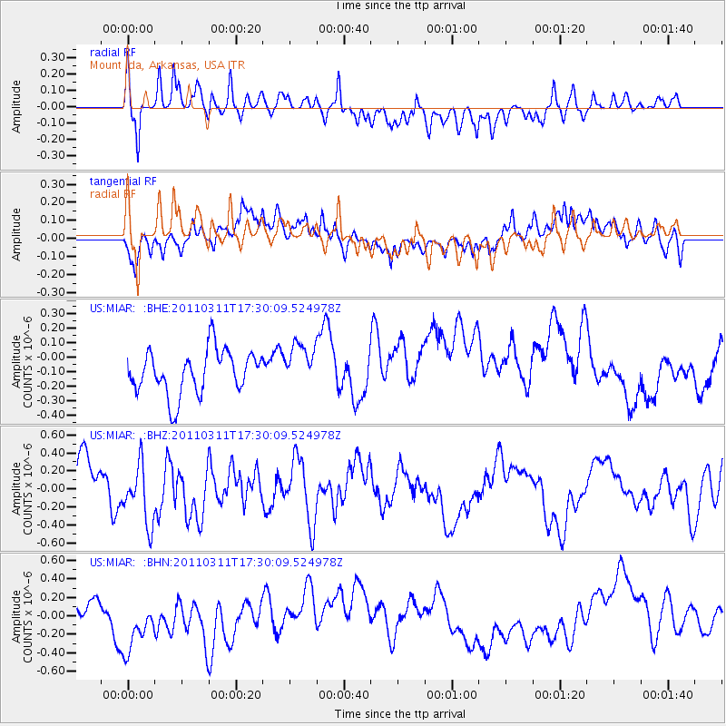
MIAR Mount Ida, Arkansas, USA - Earthquake Result Viewer
*The percent match for this event was below the threshold and hence no stack was calculated.
| Earthquake location: |
Near East Coast Of Honshu, Japan |
| Earthquake latitude/longitude: |
35.3/141.4 |
| Earthquake time(UTC): |
2011/03/11 (070) 17:17:23 GMT |
| Earthquake Depth: |
1.7 km |
| Earthquake Magnitude: |
5.5 MB |
| Earthquake Catalog/Contributor: |
WHDF/NEIC |
|
| Network: |
US United States National Seismic Network |
| Station: |
MIAR Mount Ida, Arkansas, USA |
| Lat/Lon: |
34.55 N/93.58 W |
| Elevation: |
207 m |
|
| Distance: |
93.6 deg |
| Az: |
42.627 deg |
| Baz: |
317.869 deg |
| Ray Param: |
$rayparam |
*The percent match for this event was below the threshold and hence was not used in the summary stack. |
|
| Radial Match: |
45.953667 % |
| Radial Bump: |
364 |
| Transverse Match: |
51.853172 % |
| Transverse Bump: |
400 |
| SOD ConfigId: |
356183 |
| Insert Time: |
2011-08-17 17:37:26.316 +0000 |
| GWidth: |
2.5 |
| Max Bumps: |
400 |
| Tol: |
0.001 |
|
Signal To Noise
| Channel | StoN | STA | LTA |
| US:MIAR: :BHZ:20110311T17:30:09.524978Z | 1.1940992 | 3.291555E-7 | 2.7565173E-7 |
| US:MIAR: :BHN:20110311T17:30:09.524978Z | 1.6825265 | 4.3653412E-7 | 2.5945155E-7 |
| US:MIAR: :BHE:20110311T17:30:09.524978Z | 1.0059873 | 1.526243E-7 | 1.5171592E-7 |
| Arrivals |
| Ps | |
| PpPs | |
| PsPs/PpSs | |


