You are here: Home > Network List > IW - Intermountain West Stations List
> Station MOOW Moose Ponds, Wyoming, USA > Earthquake Result Viewer
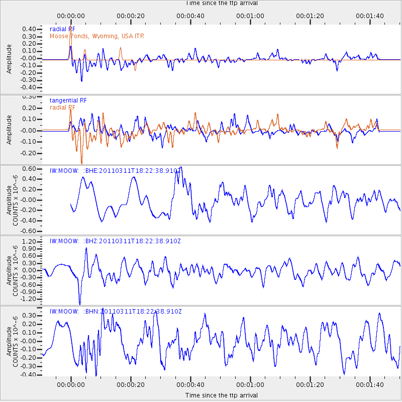
MOOW Moose Ponds, Wyoming, USA - Earthquake Result Viewer
*The percent match for this event was below the threshold and hence no stack was calculated.
| Earthquake location: |
Off East Coast Of Honshu, Japan |
| Earthquake latitude/longitude: |
37.2/142.1 |
| Earthquake time(UTC): |
2011/03/11 (070) 18:11:24 GMT |
| Earthquake Depth: |
16 km |
| Earthquake Magnitude: |
5.7 MB |
| Earthquake Catalog/Contributor: |
WHDF/NEIC |
|
| Network: |
IW Intermountain West |
| Station: |
MOOW Moose Ponds, Wyoming, USA |
| Lat/Lon: |
43.75 N/110.74 W |
| Elevation: |
2128 m |
|
| Distance: |
75.9 deg |
| Az: |
45.564 deg |
| Baz: |
308.116 deg |
| Ray Param: |
$rayparam |
*The percent match for this event was below the threshold and hence was not used in the summary stack. |
|
| Radial Match: |
46.517998 % |
| Radial Bump: |
400 |
| Transverse Match: |
52.099136 % |
| Transverse Bump: |
357 |
| SOD ConfigId: |
356183 |
| Insert Time: |
2011-08-17 18:44:53.107 +0000 |
| GWidth: |
2.5 |
| Max Bumps: |
400 |
| Tol: |
0.001 |
|
Signal To Noise
| Channel | StoN | STA | LTA |
| IW:MOOW: :BHZ:20110311T18:22:38.910Z | 2.4372168 | 5.0714374E-7 | 2.0808315E-7 |
| IW:MOOW: :BHN:20110311T18:22:38.910Z | 1.100424 | 1.7419102E-7 | 1.5829444E-7 |
| IW:MOOW: :BHE:20110311T18:22:38.910Z | 1.1146766 | 2.726321E-7 | 2.4458404E-7 |
| Arrivals |
| Ps | |
| PpPs | |
| PsPs/PpSs | |


