You are here: Home > Network List > TA - USArray Transportable Network (new EarthScope stations) Stations List
> Station K22A Casper, WY, USA > Earthquake Result Viewer
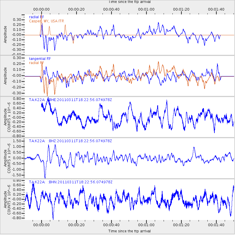
K22A Casper, WY, USA - Earthquake Result Viewer
*The percent match for this event was below the threshold and hence no stack was calculated.
| Earthquake location: |
Off East Coast Of Honshu, Japan |
| Earthquake latitude/longitude: |
37.2/142.1 |
| Earthquake time(UTC): |
2011/03/11 (070) 18:11:24 GMT |
| Earthquake Depth: |
16 km |
| Earthquake Magnitude: |
5.7 MB |
| Earthquake Catalog/Contributor: |
WHDF/NEIC |
|
| Network: |
TA USArray Transportable Network (new EarthScope stations) |
| Station: |
K22A Casper, WY, USA |
| Lat/Lon: |
42.65 N/106.52 W |
| Elevation: |
1686 m |
|
| Distance: |
79.0 deg |
| Az: |
44.424 deg |
| Baz: |
310.747 deg |
| Ray Param: |
$rayparam |
*The percent match for this event was below the threshold and hence was not used in the summary stack. |
|
| Radial Match: |
60.04796 % |
| Radial Bump: |
387 |
| Transverse Match: |
51.47869 % |
| Transverse Bump: |
386 |
| SOD ConfigId: |
356183 |
| Insert Time: |
2011-08-17 18:59:55.925 +0000 |
| GWidth: |
2.5 |
| Max Bumps: |
400 |
| Tol: |
0.001 |
|
Signal To Noise
| Channel | StoN | STA | LTA |
| TA:K22A: :BHZ:20110311T18:22:56.074978Z | 4.0677314 | 7.7005564E-7 | 1.8930838E-7 |
| TA:K22A: :BHN:20110311T18:22:56.074978Z | 0.9185468 | 2.2514575E-7 | 2.451108E-7 |
| TA:K22A: :BHE:20110311T18:22:56.074978Z | 0.93371093 | 2.9160992E-7 | 3.1231286E-7 |
| Arrivals |
| Ps | |
| PpPs | |
| PsPs/PpSs | |


