You are here: Home > Network List > TA - USArray Transportable Network (new EarthScope stations) Stations List
> Station I28A Midland, SD, USA > Earthquake Result Viewer
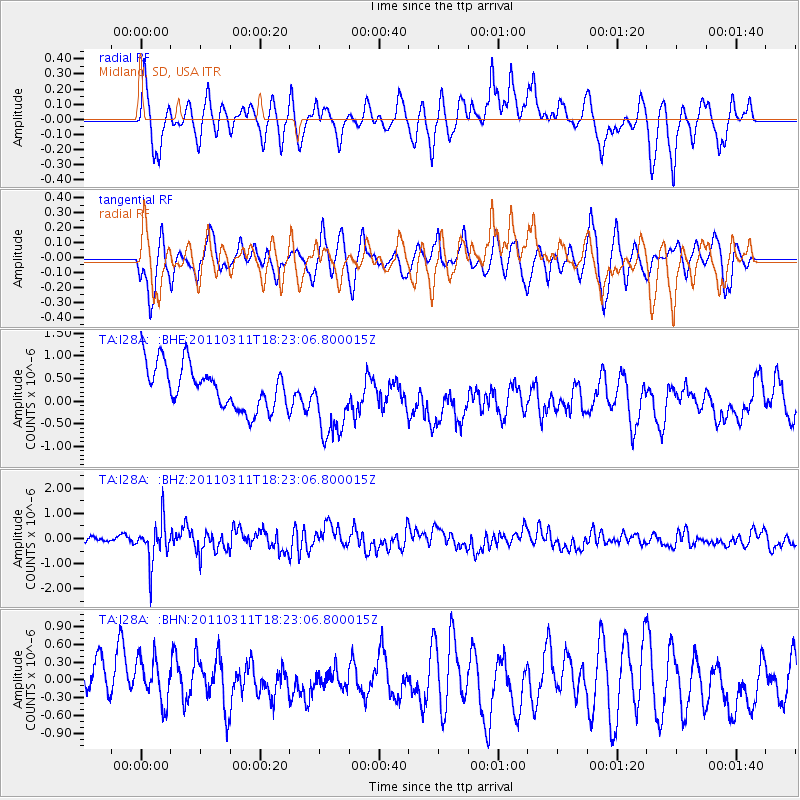
I28A Midland, SD, USA - Earthquake Result Viewer
*The percent match for this event was below the threshold and hence no stack was calculated.
| Earthquake location: |
Off East Coast Of Honshu, Japan |
| Earthquake latitude/longitude: |
37.2/142.1 |
| Earthquake time(UTC): |
2011/03/11 (070) 18:11:24 GMT |
| Earthquake Depth: |
16 km |
| Earthquake Magnitude: |
5.7 MB |
| Earthquake Catalog/Contributor: |
WHDF/NEIC |
|
| Network: |
TA USArray Transportable Network (new EarthScope stations) |
| Station: |
I28A Midland, SD, USA |
| Lat/Lon: |
44.00 N/101.17 W |
| Elevation: |
655 m |
|
| Distance: |
80.9 deg |
| Az: |
40.743 deg |
| Baz: |
313.767 deg |
| Ray Param: |
$rayparam |
*The percent match for this event was below the threshold and hence was not used in the summary stack. |
|
| Radial Match: |
67.85971 % |
| Radial Bump: |
400 |
| Transverse Match: |
63.32181 % |
| Transverse Bump: |
400 |
| SOD ConfigId: |
356183 |
| Insert Time: |
2011-08-17 19:08:18.688 +0000 |
| GWidth: |
2.5 |
| Max Bumps: |
400 |
| Tol: |
0.001 |
|
Signal To Noise
| Channel | StoN | STA | LTA |
| TA:I28A: :BHZ:20110311T18:23:06.800015Z | 4.7603397 | 8.2312533E-7 | 1.7291313E-7 |
| TA:I28A: :BHN:20110311T18:23:06.800015Z | 0.86515665 | 4.3246197E-7 | 4.998655E-7 |
| TA:I28A: :BHE:20110311T18:23:06.800015Z | 1.761536 | 8.432792E-7 | 4.787181E-7 |
| Arrivals |
| Ps | |
| PpPs | |
| PsPs/PpSs | |


