You are here: Home > Network List > TA - USArray Transportable Network (new EarthScope stations) Stations List
> Station I27A Quinn, SD, USA > Earthquake Result Viewer
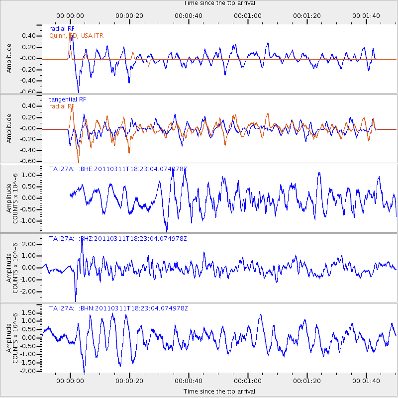
I27A Quinn, SD, USA - Earthquake Result Viewer
*The percent match for this event was below the threshold and hence no stack was calculated.
| Earthquake location: |
Off East Coast Of Honshu, Japan |
| Earthquake latitude/longitude: |
37.2/142.1 |
| Earthquake time(UTC): |
2011/03/11 (070) 18:11:24 GMT |
| Earthquake Depth: |
16 km |
| Earthquake Magnitude: |
5.7 MB |
| Earthquake Catalog/Contributor: |
WHDF/NEIC |
|
| Network: |
TA USArray Transportable Network (new EarthScope stations) |
| Station: |
I27A Quinn, SD, USA |
| Lat/Lon: |
44.07 N/102.05 W |
| Elevation: |
867 m |
|
| Distance: |
80.4 deg |
| Az: |
41.136 deg |
| Baz: |
313.219 deg |
| Ray Param: |
$rayparam |
*The percent match for this event was below the threshold and hence was not used in the summary stack. |
|
| Radial Match: |
72.22263 % |
| Radial Bump: |
339 |
| Transverse Match: |
57.308376 % |
| Transverse Bump: |
389 |
| SOD ConfigId: |
356183 |
| Insert Time: |
2011-08-17 19:08:27.924 +0000 |
| GWidth: |
2.5 |
| Max Bumps: |
400 |
| Tol: |
0.001 |
|
Signal To Noise
| Channel | StoN | STA | LTA |
| TA:I27A: :BHZ:20110311T18:23:04.074978Z | 5.2103486 | 1.1021777E-6 | 2.1153627E-7 |
| TA:I27A: :BHN:20110311T18:23:04.074978Z | 2.0181077 | 7.355427E-7 | 3.6447148E-7 |
| TA:I27A: :BHE:20110311T18:23:04.074978Z | 2.177242 | 7.786472E-7 | 3.5763006E-7 |
| Arrivals |
| Ps | |
| PpPs | |
| PsPs/PpSs | |


