You are here: Home > Network List > TA - USArray Transportable Network (new EarthScope stations) Stations List
> Station F27A Lemmon, SD, USA > Earthquake Result Viewer
F27A Lemmon, SD, USA - Earthquake Result Viewer
*The percent match for this event was below the threshold and hence no stack was calculated.
| Earthquake location: |
Off East Coast Of Honshu, Japan |
| Earthquake latitude/longitude: |
37.2/142.1 |
| Earthquake time(UTC): |
2011/03/11 (070) 18:11:24 GMT |
| Earthquake Depth: |
16 km |
| Earthquake Magnitude: |
5.7 MB |
| Earthquake Catalog/Contributor: |
WHDF/NEIC |
|
| Network: |
TA USArray Transportable Network (new EarthScope stations) |
| Station: |
F27A Lemmon, SD, USA |
| Lat/Lon: |
45.87 N/102.02 W |
| Elevation: |
757 m |
|
| Distance: |
79.2 deg |
| Az: |
39.783 deg |
| Baz: |
313.002 deg |
| Ray Param: |
$rayparam |
*The percent match for this event was below the threshold and hence was not used in the summary stack. |
|
| Radial Match: |
55.69869 % |
| Radial Bump: |
303 |
| Transverse Match: |
50.183693 % |
| Transverse Bump: |
309 |
| SOD ConfigId: |
356183 |
| Insert Time: |
2011-08-17 19:11:10.447 +0000 |
| GWidth: |
2.5 |
| Max Bumps: |
400 |
| Tol: |
0.001 |
|
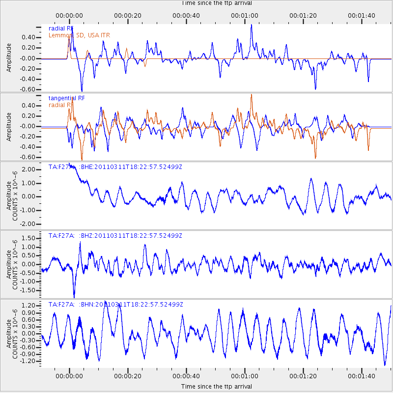
Signal To Noise
| Channel | StoN | STA | LTA |
| TA:F27A: :BHZ:20110311T18:22:57.52499Z | 2.875575 | 7.2898365E-7 | 2.5350883E-7 |
| TA:F27A: :BHN:20110311T18:22:57.52499Z | 0.96065015 | 5.6612953E-7 | 5.893192E-7 |
| TA:F27A: :BHE:20110311T18:22:57.52499Z | 0.74966127 | 6.162955E-7 | 8.220986E-7 |
| Arrivals |
| Ps | |
| PpPs | |
| PsPs/PpSs | |


