You are here: Home > Network List > TA - USArray Transportable Network (new EarthScope stations) Stations List
> Station H29A Onida, SD, USA > Earthquake Result Viewer
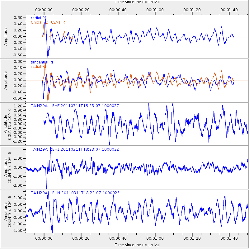
H29A Onida, SD, USA - Earthquake Result Viewer
*The percent match for this event was below the threshold and hence no stack was calculated.
| Earthquake location: |
Off East Coast Of Honshu, Japan |
| Earthquake latitude/longitude: |
37.2/142.1 |
| Earthquake time(UTC): |
2011/03/11 (070) 18:11:24 GMT |
| Earthquake Depth: |
16 km |
| Earthquake Magnitude: |
5.7 MB |
| Earthquake Catalog/Contributor: |
WHDF/NEIC |
|
| Network: |
TA USArray Transportable Network (new EarthScope stations) |
| Station: |
H29A Onida, SD, USA |
| Lat/Lon: |
44.63 N/100.21 W |
| Elevation: |
548 m |
|
| Distance: |
81.0 deg |
| Az: |
39.804 deg |
| Baz: |
314.286 deg |
| Ray Param: |
$rayparam |
*The percent match for this event was below the threshold and hence was not used in the summary stack. |
|
| Radial Match: |
64.62255 % |
| Radial Bump: |
400 |
| Transverse Match: |
61.26392 % |
| Transverse Bump: |
400 |
| SOD ConfigId: |
356183 |
| Insert Time: |
2011-08-17 19:19:25.692 +0000 |
| GWidth: |
2.5 |
| Max Bumps: |
400 |
| Tol: |
0.001 |
|
Signal To Noise
| Channel | StoN | STA | LTA |
| TA:H29A: :BHZ:20110311T18:23:07.100002Z | 4.1236553 | 9.043157E-7 | 2.1929955E-7 |
| TA:H29A: :BHN:20110311T18:23:07.100002Z | 3.6282468 | 8.709E-7 | 2.400333E-7 |
| TA:H29A: :BHE:20110311T18:23:07.100002Z | 0.9858465 | 5.179949E-7 | 5.2543163E-7 |
| Arrivals |
| Ps | |
| PpPs | |
| PsPs/PpSs | |


