You are here: Home > Network List > TA - USArray Transportable Network (new EarthScope stations) Stations List
> Station A04D Lummi Island, WA, USA > Earthquake Result Viewer
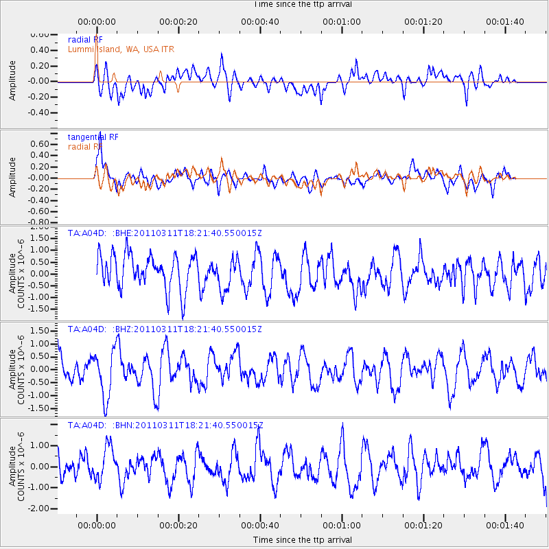
A04D Lummi Island, WA, USA - Earthquake Result Viewer
*The percent match for this event was below the threshold and hence no stack was calculated.
| Earthquake location: |
Off East Coast Of Honshu, Japan |
| Earthquake latitude/longitude: |
37.2/142.1 |
| Earthquake time(UTC): |
2011/03/11 (070) 18:11:24 GMT |
| Earthquake Depth: |
16 km |
| Earthquake Magnitude: |
5.7 MB |
| Earthquake Catalog/Contributor: |
WHDF/NEIC |
|
| Network: |
TA USArray Transportable Network (new EarthScope stations) |
| Station: |
A04D Lummi Island, WA, USA |
| Lat/Lon: |
48.72 N/122.71 W |
| Elevation: |
13 m |
|
| Distance: |
66.2 deg |
| Az: |
46.11 deg |
| Baz: |
299.66 deg |
| Ray Param: |
$rayparam |
*The percent match for this event was below the threshold and hence was not used in the summary stack. |
|
| Radial Match: |
50.36285 % |
| Radial Bump: |
400 |
| Transverse Match: |
66.31648 % |
| Transverse Bump: |
400 |
| SOD ConfigId: |
356183 |
| Insert Time: |
2011-08-17 19:37:12.532 +0000 |
| GWidth: |
2.5 |
| Max Bumps: |
400 |
| Tol: |
0.001 |
|
Signal To Noise
| Channel | StoN | STA | LTA |
| TA:A04D: :BHZ:20110311T18:21:40.550015Z | 1.6183758 | 9.3124316E-7 | 5.7541837E-7 |
| TA:A04D: :BHN:20110311T18:21:40.550015Z | 0.86052215 | 8.4060395E-7 | 9.768534E-7 |
| TA:A04D: :BHE:20110311T18:21:40.550015Z | 0.99051434 | 7.066261E-7 | 7.1339315E-7 |
| Arrivals |
| Ps | |
| PpPs | |
| PsPs/PpSs | |


