You are here: Home > Network List > TA - USArray Transportable Network (new EarthScope stations) Stations List
> Station E31A Nome, ND, USA > Earthquake Result Viewer
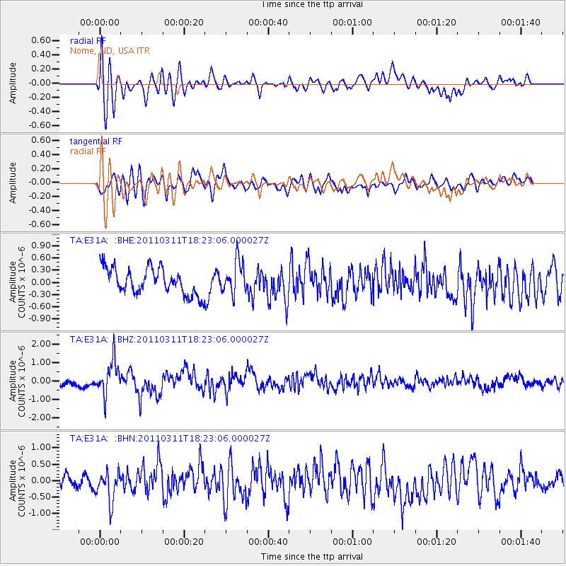
E31A Nome, ND, USA - Earthquake Result Viewer
*The percent match for this event was below the threshold and hence no stack was calculated.
| Earthquake location: |
Off East Coast Of Honshu, Japan |
| Earthquake latitude/longitude: |
37.2/142.1 |
| Earthquake time(UTC): |
2011/03/11 (070) 18:11:24 GMT |
| Earthquake Depth: |
16 km |
| Earthquake Magnitude: |
5.7 MB |
| Earthquake Catalog/Contributor: |
WHDF/NEIC |
|
| Network: |
TA USArray Transportable Network (new EarthScope stations) |
| Station: |
E31A Nome, ND, USA |
| Lat/Lon: |
46.56 N/97.89 W |
| Elevation: |
427 m |
|
| Distance: |
80.8 deg |
| Az: |
37.251 deg |
| Baz: |
315.537 deg |
| Ray Param: |
$rayparam |
*The percent match for this event was below the threshold and hence was not used in the summary stack. |
|
| Radial Match: |
74.151085 % |
| Radial Bump: |
400 |
| Transverse Match: |
66.08096 % |
| Transverse Bump: |
400 |
| SOD ConfigId: |
356183 |
| Insert Time: |
2011-08-17 19:37:13.088 +0000 |
| GWidth: |
2.5 |
| Max Bumps: |
400 |
| Tol: |
0.001 |
|
Signal To Noise
| Channel | StoN | STA | LTA |
| TA:E31A: :BHZ:20110311T18:23:06.000027Z | 3.8768175 | 9.2220205E-7 | 2.3787605E-7 |
| TA:E31A: :BHN:20110311T18:23:06.000027Z | 2.104022 | 4.7938164E-7 | 2.2784059E-7 |
| TA:E31A: :BHE:20110311T18:23:06.000027Z | 1.288939 | 4.1176565E-7 | 3.1946092E-7 |
| Arrivals |
| Ps | |
| PpPs | |
| PsPs/PpSs | |


