I28A Midland, SD, USA - Earthquake Result Viewer
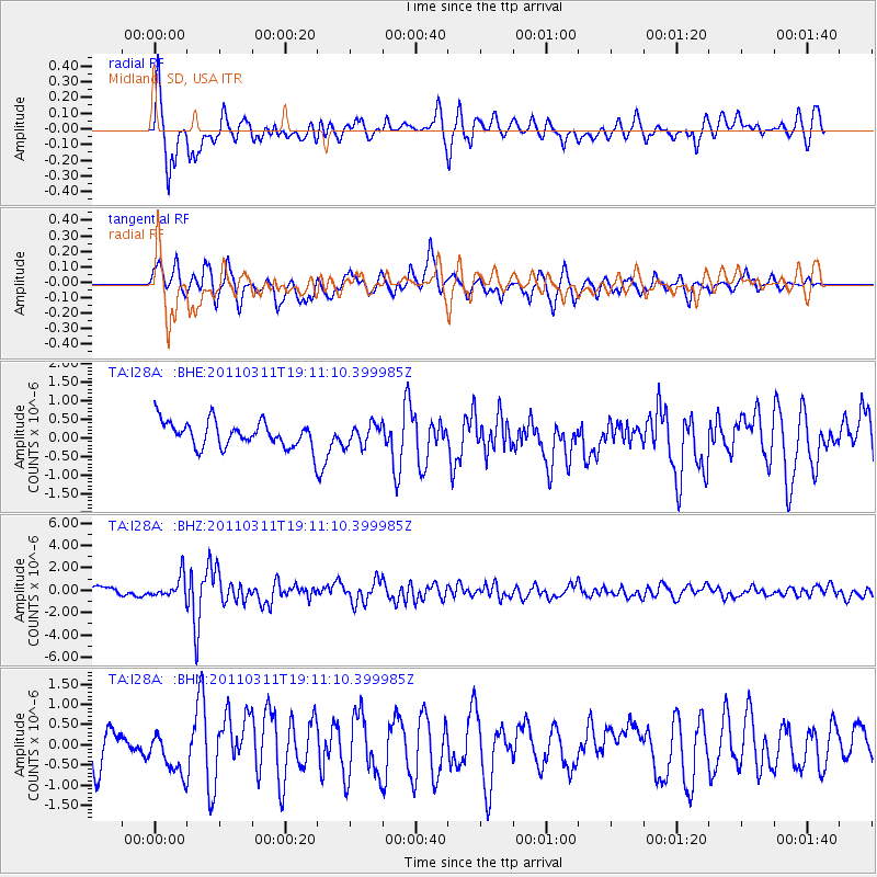
Earthquake location: Near West Coast Of Honshu, Japan
Earthquake latitude/longitude: 37.0/138.4
Earthquake time(UTC): 2011/03/11 (070) 18:59:16 GMT
Earthquake Depth: 9.3 km
Earthquake Magnitude: 6.1 MB, 6.1 MS, 6.3 MW, 6.2 MW
Earthquake Catalog/Contributor: WHDF/NEIC
Network: TA USArray Transportable Network (new EarthScope stations)
Station: I28A Midland, SD, USA
Lat/Lon: 44.00 N/101.17 W
Elevation: 655 m
Distance: 83.0 deg
Az: 38.814 deg
Baz: 315.957 deg
Ray Param: 0.0465098
Estimated Moho Depth: 11.5 km
Estimated Crust Vp/Vs: 1.60
Assumed Crust Vp: 6.483 km/s
Estimated Crust Vs: 4.052 km/s
Estimated Crust Poisson's Ratio: 0.18
Radial Match: 84.25071 %
Radial Bump: 400
Transverse Match: 76.32946 %
Transverse Bump: 400
SOD ConfigId: 356183
Insert Time: 2011-08-17 22:35:22.741 +0000
GWidth: 2.5
Max Bumps: 400
Tol: 0.001

Signal To Noise

ChannelStoNSTALTA
TA:I28A: :BHZ:20110311T19:11:10.399985Z3.1620839.717116E-73.0730112E-7
TA:I28A: :BHN:20110311T19:11:10.399985Z1.25774365.5995685E-74.4520746E-7
TA:I28A: :BHE:20110311T19:11:10.399985Z0.825262372.852879E-73.456936E-7
Arrivals
Ps1.1 SECOND
PpPs4.5 SECOND
PsPs/PpSs5.6 SECOND