You are here: Home > Network List > TA - USArray Transportable Network (new EarthScope stations) Stations List
> Station D27A Center, ND, USA > Earthquake Result Viewer
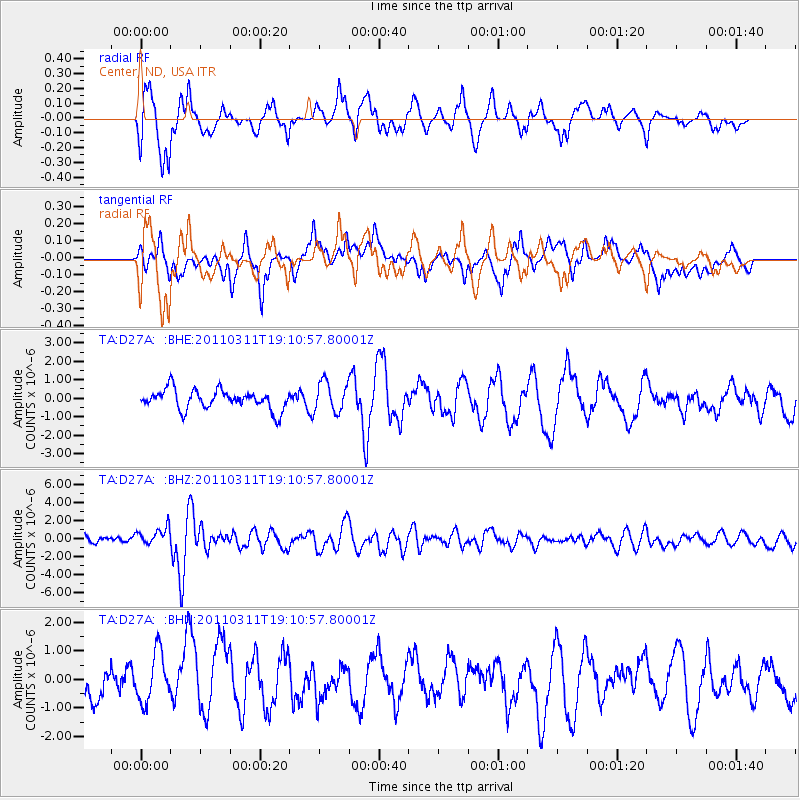
D27A Center, ND, USA - Earthquake Result Viewer
*The percent match for this event was below the threshold and hence no stack was calculated.
| Earthquake location: |
Near West Coast Of Honshu, Japan |
| Earthquake latitude/longitude: |
37.0/138.4 |
| Earthquake time(UTC): |
2011/03/11 (070) 18:59:16 GMT |
| Earthquake Depth: |
9.3 km |
| Earthquake Magnitude: |
6.1 MB, 6.1 MS, 6.3 MW, 6.2 MW |
| Earthquake Catalog/Contributor: |
WHDF/NEIC |
|
| Network: |
TA USArray Transportable Network (new EarthScope stations) |
| Station: |
D27A Center, ND, USA |
| Lat/Lon: |
47.11 N/101.53 W |
| Elevation: |
685 m |
|
| Distance: |
80.6 deg |
| Az: |
36.801 deg |
| Baz: |
315.416 deg |
| Ray Param: |
$rayparam |
*The percent match for this event was below the threshold and hence was not used in the summary stack. |
|
| Radial Match: |
80.0388 % |
| Radial Bump: |
400 |
| Transverse Match: |
72.81668 % |
| Transverse Bump: |
400 |
| SOD ConfigId: |
356183 |
| Insert Time: |
2011-08-17 22:37:38.608 +0000 |
| GWidth: |
2.5 |
| Max Bumps: |
400 |
| Tol: |
0.001 |
|
Signal To Noise
| Channel | StoN | STA | LTA |
| TA:D27A: :BHZ:20110311T19:10:57.80001Z | 2.4434211 | 1.05122E-6 | 4.3022465E-7 |
| TA:D27A: :BHN:20110311T19:10:57.80001Z | 1.5793283 | 9.2176316E-7 | 5.8364253E-7 |
| TA:D27A: :BHE:20110311T19:10:57.80001Z | 1.5283427 | 8.171759E-7 | 5.34681E-7 |
| Arrivals |
| Ps | |
| PpPs | |
| PsPs/PpSs | |


