You are here: Home > Network List > TA - USArray Transportable Network (new EarthScope stations) Stations List
> Station A29A Manning Farm, Rocklake, ND, USA > Earthquake Result Viewer
A29A Manning Farm, Rocklake, ND, USA - Earthquake Result Viewer
| Earthquake location: |
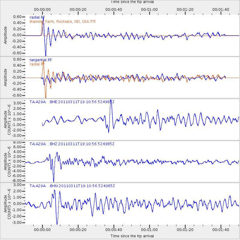
Near West Coast Of Honshu, Japan |
| Earthquake latitude/longitude: |
37.0/138.4 |
| Earthquake time(UTC): |
2011/03/11 (070) 18:59:16 GMT |
| Earthquake Depth: |
9.3 km |
| Earthquake Magnitude: |
6.1 MB, 6.1 MS, 6.3 MW, 6.2 MW |
| Earthquake Catalog/Contributor: |
WHDF/NEIC |
|
| Network: |
TA USArray Transportable Network (new EarthScope stations) |
| Station: |
A29A Manning Farm, Rocklake, ND, USA |
| Lat/Lon: |
48.92 N/99.23 W |
| Elevation: |
480 m |
|
| Distance: |
80.3 deg |
| Az: |
34.399 deg |
| Baz: |
316.718 deg |
| Ray Param: |
0.048341762 |
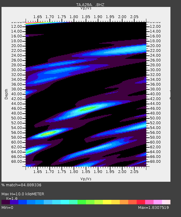
| Estimated Moho Depth: |
10.0 km |
| Estimated Crust Vp/Vs: |
1.60 |
| Assumed Crust Vp: |
6.53 km/s |
| Estimated Crust Vs: |
4.082 km/s |
| Estimated Crust Poisson's Ratio: |
0.18 |
|
| Radial Match: |
84.889336 % |
| Radial Bump: |
400 |
| Transverse Match: |
70.788506 % |
| Transverse Bump: |
400 |
| SOD ConfigId: |
356183 |
| Insert Time: |
2011-08-17 22:45:10.990 +0000 |
| GWidth: |
2.5 |
| Max Bumps: |
400 |
| Tol: |
0.001 |
|
Signal To Noise
| Channel | StoN | STA | LTA |
| TA:A29A: :BHZ:20110311T19:10:56.524985Z | 3.8867836 | 1.2660213E-6 | 3.2572467E-7 |
| TA:A29A: :BHN:20110311T19:10:56.524985Z | 0.8289788 | 4.3489206E-7 | 5.2461183E-7 |
| TA:A29A: :BHE:20110311T19:10:56.524985Z | 0.83884436 | 3.355621E-7 | 4.0002905E-7 |
| Arrivals |
| Ps | 0.9 SECOND |
| PpPs | 3.9 SECOND |
| PsPs/PpSs | 4.8 SECOND |


