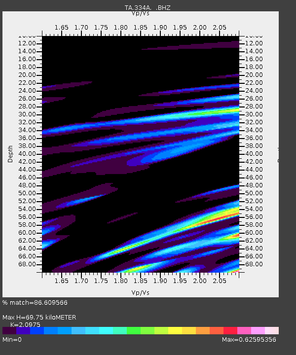
334A Lometa, TX, USA - Earthquake Result Viewer
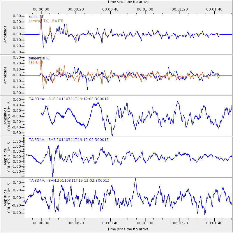
Earthquake location: Near West Coast Of Honshu, Japan
Earthquake latitude/longitude: 37.0/138.4
Earthquake time(UTC): 2011/03/11 (070) 18:59:16 GMT
Earthquake Depth: 9.3 km
Earthquake Magnitude: 6.1 MB, 6.1 MS, 6.3 MW, 6.2 MW
Earthquake Catalog/Contributor: WHDF/NEIC
Network: TA USArray Transportable Network (new EarthScope stations)
Station: 334A Lometa, TX, USA
Lat/Lon: 31.33 N/98.24 W
Elevation: 389 m
Distance: 93.8 deg
Az: 45.733 deg
Baz: 317.946 deg
Ray Param: 0.04118434
Estimated Moho Depth: 69.75 km
Estimated Crust Vp/Vs: 2.10
Assumed Crust Vp: 6.498 km/s
Estimated Crust Vs: 3.098 km/s
Estimated Crust Poisson's Ratio: 0.35
Radial Match: 86.609566 %
Radial Bump: 400
Transverse Match: 68.02414 %
Transverse Bump: 400
SOD ConfigId: 356183
Insert Time: 2011-08-17 22:54:56.482 +0000
GWidth: 2.5
Max Bumps: 400
Tol: 0.001

Signal To Noise

ChannelStoNSTALTA
TA:334A: :BHZ:20110311T19:12:02.30001Z1.74849595.3547654E-73.0624983E-7
TA:334A: :BHN:20110311T19:12:02.30001Z1.05117131.3368037E-71.2717278E-7
TA:334A: :BHE:20110311T19:12:02.30001Z2.04258133.8676768E-71.893524E-7
Arrivals
Ps12 SECOND
PpPs33 SECOND
PsPs/PpSs45 SECOND