You are here: Home > Network List > TA - USArray Transportable Network (new EarthScope stations) Stations List
> Station 340A Bronson, TX, USA > Earthquake Result Viewer
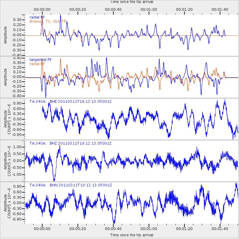
340A Bronson, TX, USA - Earthquake Result Viewer
*The percent match for this event was below the threshold and hence no stack was calculated.
| Earthquake location: |
Near West Coast Of Honshu, Japan |
| Earthquake latitude/longitude: |
37.0/138.4 |
| Earthquake time(UTC): |
2011/03/11 (070) 18:59:16 GMT |
| Earthquake Depth: |
9.3 km |
| Earthquake Magnitude: |
6.1 MB, 6.1 MS, 6.3 MW, 6.2 MW |
| Earthquake Catalog/Contributor: |
WHDF/NEIC |
|
| Network: |
TA USArray Transportable Network (new EarthScope stations) |
| Station: |
340A Bronson, TX, USA |
| Lat/Lon: |
31.42 N/93.89 W |
| Elevation: |
57 m |
|
| Distance: |
96.2 deg |
| Az: |
42.852 deg |
| Baz: |
320.451 deg |
| Ray Param: |
$rayparam |
*The percent match for this event was below the threshold and hence was not used in the summary stack. |
|
| Radial Match: |
59.37084 % |
| Radial Bump: |
356 |
| Transverse Match: |
64.7408 % |
| Transverse Bump: |
320 |
| SOD ConfigId: |
356183 |
| Insert Time: |
2011-08-17 22:58:40.974 +0000 |
| GWidth: |
2.5 |
| Max Bumps: |
400 |
| Tol: |
0.001 |
|
Signal To Noise
| Channel | StoN | STA | LTA |
| TA:340A: :BHZ:20110311T19:12:13.05001Z | 1.2478509 | 3.6197946E-7 | 2.900823E-7 |
| TA:340A: :BHN:20110311T19:12:13.05001Z | 1.0464429 | 3.1636594E-7 | 3.023251E-7 |
| TA:340A: :BHE:20110311T19:12:13.05001Z | 1.2965336 | 4.789123E-7 | 3.69379E-7 |
| Arrivals |
| Ps | |
| PpPs | |
| PsPs/PpSs | |


