J31A Geddes, SD, USA - Earthquake Result Viewer
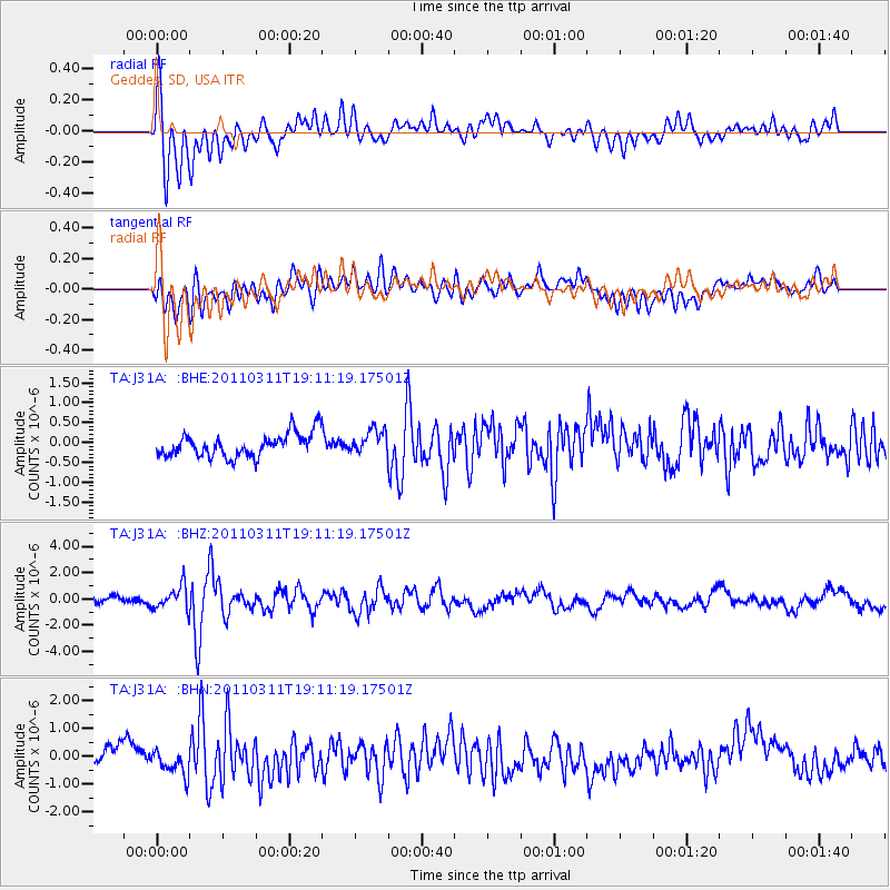
Earthquake location: Near West Coast Of Honshu, Japan
Earthquake latitude/longitude: 37.0/138.4
Earthquake time(UTC): 2011/03/11 (070) 18:59:16 GMT
Earthquake Depth: 9.3 km
Earthquake Magnitude: 6.1 MB, 6.1 MS, 6.3 MW, 6.2 MW
Earthquake Catalog/Contributor: WHDF/NEIC
Network: TA USArray Transportable Network (new EarthScope stations)
Station: J31A Geddes, SD, USA
Lat/Lon: 43.29 N/98.74 W
Elevation: 491 m
Distance: 84.7 deg
Az: 38.01 deg
Baz: 317.542 deg
Ray Param: 0.045291014
Estimated Moho Depth: 17.75 km
Estimated Crust Vp/Vs: 1.80
Assumed Crust Vp: 6.53 km/s
Estimated Crust Vs: 3.623 km/s
Estimated Crust Poisson's Ratio: 0.28
Radial Match: 82.28505 %
Radial Bump: 400
Transverse Match: 61.564003 %
Transverse Bump: 400
SOD ConfigId: 356183
Insert Time: 2011-08-17 23:11:06.534 +0000
GWidth: 2.5
Max Bumps: 400
Tol: 0.001

Signal To Noise

ChannelStoNSTALTA
TA:J31A: :BHZ:20110311T19:11:19.17501Z4.76158338.893154E-71.8676886E-7
TA:J31A: :BHN:20110311T19:11:19.17501Z0.85990513.7514755E-74.3626622E-7
TA:J31A: :BHE:20110311T19:11:19.17501Z1.00453732.9527087E-72.9393718E-7
Arrivals
Ps2.2 SECOND
PpPs7.4 SECOND
PsPs/PpSs9.7 SECOND