G31A Conde, SD, USA - Earthquake Result Viewer
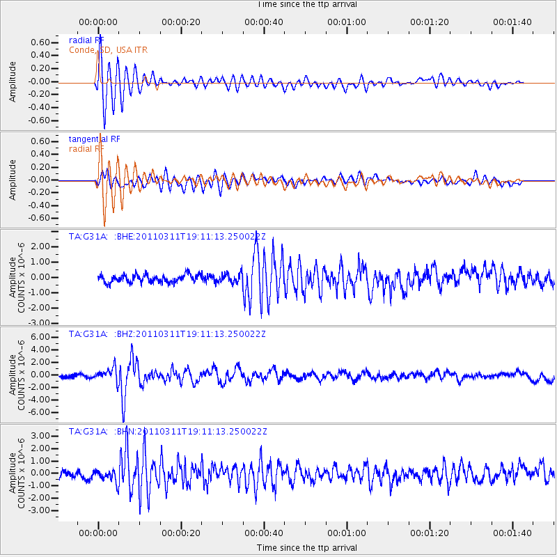
Earthquake location: Near West Coast Of Honshu, Japan
Earthquake latitude/longitude: 37.0/138.4
Earthquake time(UTC): 2011/03/11 (070) 18:59:16 GMT
Earthquake Depth: 9.3 km
Earthquake Magnitude: 6.1 MB, 6.1 MS, 6.3 MW, 6.2 MW
Earthquake Catalog/Contributor: WHDF/NEIC
Network: TA USArray Transportable Network (new EarthScope stations)
Station: G31A Conde, SD, USA
Lat/Lon: 45.23 N/98.21 W
Elevation: 393 m
Distance: 83.5 deg
Az: 36.417 deg
Baz: 317.748 deg
Ray Param: 0.046120275
Estimated Moho Depth: 54.25 km
Estimated Crust Vp/Vs: 2.05
Assumed Crust Vp: 6.53 km/s
Estimated Crust Vs: 3.186 km/s
Estimated Crust Poisson's Ratio: 0.34
Radial Match: 88.68987 %
Radial Bump: 400
Transverse Match: 72.269516 %
Transverse Bump: 400
SOD ConfigId: 356183
Insert Time: 2011-08-17 23:17:02.077 +0000
GWidth: 2.5
Max Bumps: 400
Tol: 0.001

Signal To Noise

ChannelStoNSTALTA
TA:G31A: :BHZ:20110311T19:11:13.250022Z4.23843241.091376E-62.5749517E-7
TA:G31A: :BHN:20110311T19:11:13.250022Z1.36727794.8193533E-73.5247797E-7
TA:G31A: :BHE:20110311T19:11:13.250022Z1.16242042.9577748E-72.5444965E-7
Arrivals
Ps8.9 SECOND
PpPs25 SECOND
PsPs/PpSs34 SECOND