G34A Benson, MN, USA - Earthquake Result Viewer
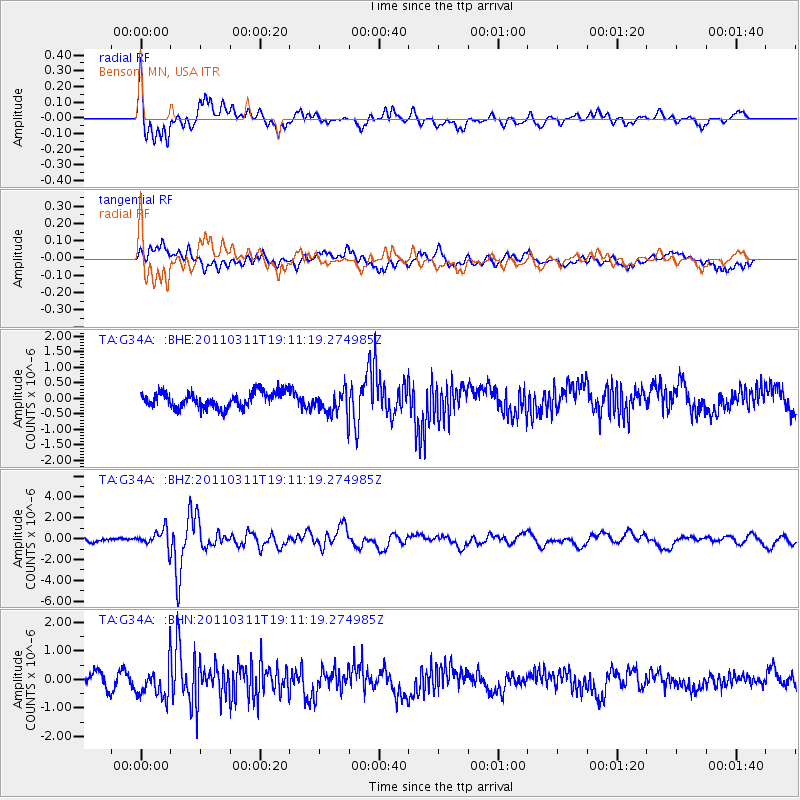
Earthquake location: Near West Coast Of Honshu, Japan
Earthquake latitude/longitude: 37.0/138.4
Earthquake time(UTC): 2011/03/11 (070) 18:59:16 GMT
Earthquake Depth: 9.3 km
Earthquake Magnitude: 6.1 MB, 6.1 MS, 6.3 MW, 6.2 MW
Earthquake Catalog/Contributor: WHDF/NEIC
Network: TA USArray Transportable Network (new EarthScope stations)
Station: G34A Benson, MN, USA
Lat/Lon: 45.24 N/95.64 W
Elevation: 316 m
Distance: 84.7 deg
Az: 35.037 deg
Baz: 319.426 deg
Ray Param: 0.04527858
Estimated Moho Depth: 58.5 km
Estimated Crust Vp/Vs: 2.10
Assumed Crust Vp: 6.571 km/s
Estimated Crust Vs: 3.133 km/s
Estimated Crust Poisson's Ratio: 0.35
Radial Match: 83.6595 %
Radial Bump: 400
Transverse Match: 67.702225 %
Transverse Bump: 400
SOD ConfigId: 356183
Insert Time: 2011-08-17 23:19:10.963 +0000
GWidth: 2.5
Max Bumps: 400
Tol: 0.001

Signal To Noise

ChannelStoNSTALTA
TA:G34A: :BHZ:20110311T19:11:19.274985Z3.59679538.414162E-72.3393497E-7
TA:G34A: :BHN:20110311T19:11:19.274985Z2.22954465.694056E-72.5539094E-7
TA:G34A: :BHE:20110311T19:11:19.274985Z1.60090514.0531455E-72.5317837E-7
Arrivals
Ps10.0 SECOND
PpPs27 SECOND
PsPs/PpSs37 SECOND