You are here: Home > Network List > US - United States National Seismic Network Stations List
> Station WMOK Wichita Mountains, Oklahoma, USA > Earthquake Result Viewer
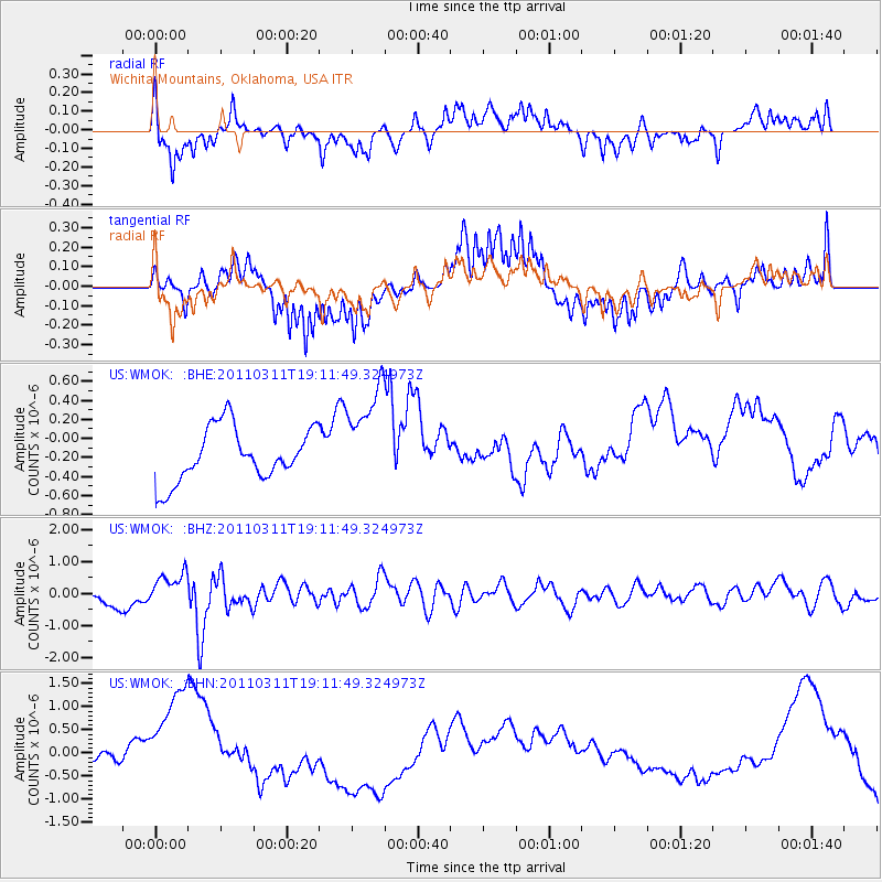
WMOK Wichita Mountains, Oklahoma, USA - Earthquake Result Viewer
*The percent match for this event was below the threshold and hence no stack was calculated.
| Earthquake location: |
Near West Coast Of Honshu, Japan |
| Earthquake latitude/longitude: |
37.0/138.4 |
| Earthquake time(UTC): |
2011/03/11 (070) 18:59:16 GMT |
| Earthquake Depth: |
9.3 km |
| Earthquake Magnitude: |
6.1 MB, 6.1 MS, 6.3 MW, 6.2 MW |
| Earthquake Catalog/Contributor: |
WHDF/NEIC |
|
| Network: |
US United States National Seismic Network |
| Station: |
WMOK Wichita Mountains, Oklahoma, USA |
| Lat/Lon: |
34.74 N/98.78 W |
| Elevation: |
486 m |
|
| Distance: |
91.0 deg |
| Az: |
43.79 deg |
| Baz: |
317.733 deg |
| Ray Param: |
$rayparam |
*The percent match for this event was below the threshold and hence was not used in the summary stack. |
|
| Radial Match: |
32.566967 % |
| Radial Bump: |
301 |
| Transverse Match: |
33.571186 % |
| Transverse Bump: |
294 |
| SOD ConfigId: |
356183 |
| Insert Time: |
2011-08-17 23:32:58.076 +0000 |
| GWidth: |
2.5 |
| Max Bumps: |
400 |
| Tol: |
0.001 |
|
Signal To Noise
| Channel | StoN | STA | LTA |
| US:WMOK: :BHZ:20110311T19:11:49.324973Z | 1.3841938 | 4.2760703E-7 | 3.0892136E-7 |
| US:WMOK: :BHN:20110311T19:11:49.324973Z | 4.179557 | 1.3949599E-6 | 3.3375784E-7 |
| US:WMOK: :BHE:20110311T19:11:49.324973Z | 1.909579 | 5.334629E-7 | 2.7936153E-7 |
| Arrivals |
| Ps | |
| PpPs | |
| PsPs/PpSs | |


