You are here: Home > Network List > US - United States National Seismic Network Stations List
> Station CBKS Cedar Bluff, Kansas, USA > Earthquake Result Viewer
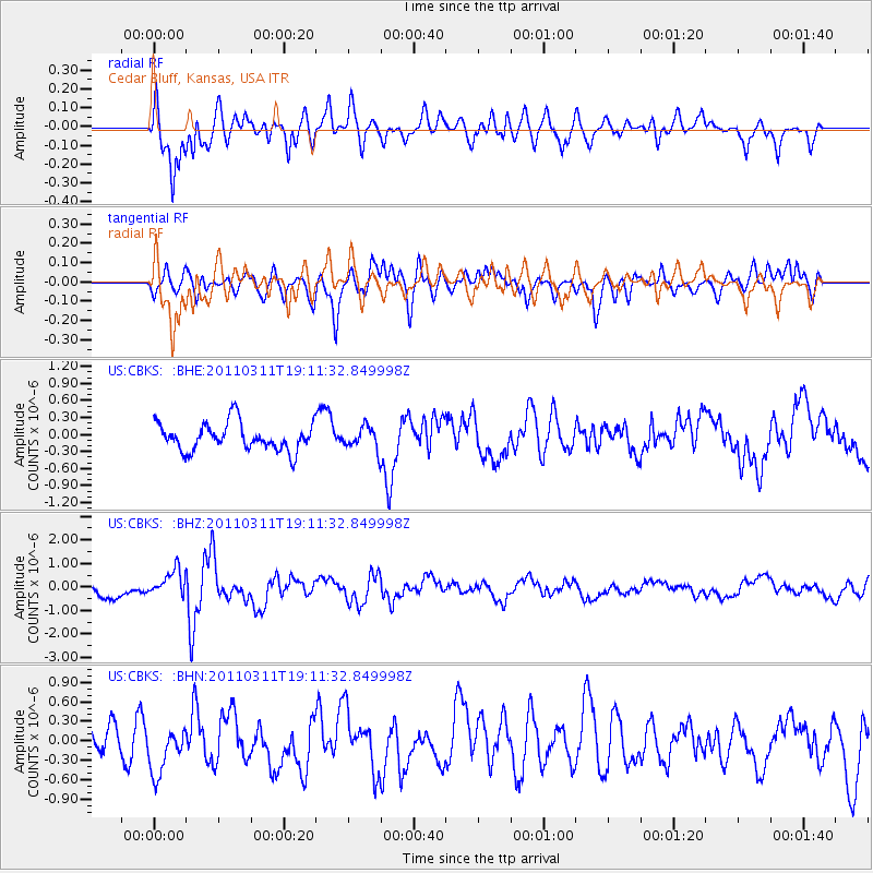
CBKS Cedar Bluff, Kansas, USA - Earthquake Result Viewer
*The percent match for this event was below the threshold and hence no stack was calculated.
| Earthquake location: |
Near West Coast Of Honshu, Japan |
| Earthquake latitude/longitude: |
37.0/138.4 |
| Earthquake time(UTC): |
2011/03/11 (070) 18:59:16 GMT |
| Earthquake Depth: |
9.3 km |
| Earthquake Magnitude: |
6.1 MB, 6.1 MS, 6.3 MW, 6.2 MW |
| Earthquake Catalog/Contributor: |
WHDF/NEIC |
|
| Network: |
US United States National Seismic Network |
| Station: |
CBKS Cedar Bluff, Kansas, USA |
| Lat/Lon: |
38.81 N/99.74 W |
| Elevation: |
677 m |
|
| Distance: |
87.5 deg |
| Az: |
41.604 deg |
| Baz: |
317.133 deg |
| Ray Param: |
$rayparam |
*The percent match for this event was below the threshold and hence was not used in the summary stack. |
|
| Radial Match: |
84.54077 % |
| Radial Bump: |
400 |
| Transverse Match: |
67.9404 % |
| Transverse Bump: |
400 |
| SOD ConfigId: |
356183 |
| Insert Time: |
2011-08-17 23:34:39.613 +0000 |
| GWidth: |
2.5 |
| Max Bumps: |
400 |
| Tol: |
0.001 |
|
Signal To Noise
| Channel | StoN | STA | LTA |
| US:CBKS: :BHZ:20110311T19:11:32.849998Z | 1.5909705 | 5.4643687E-7 | 3.4346135E-7 |
| US:CBKS: :BHN:20110311T19:11:32.849998Z | 1.766271 | 4.0798108E-7 | 2.3098441E-7 |
| US:CBKS: :BHE:20110311T19:11:32.849998Z | 0.81248474 | 1.9702274E-7 | 2.4249408E-7 |
| Arrivals |
| Ps | |
| PpPs | |
| PsPs/PpSs | |


