You are here: Home > Network List > US - United States National Seismic Network Stations List
> Station DGMT Dagmar, Montana, USA > Earthquake Result Viewer
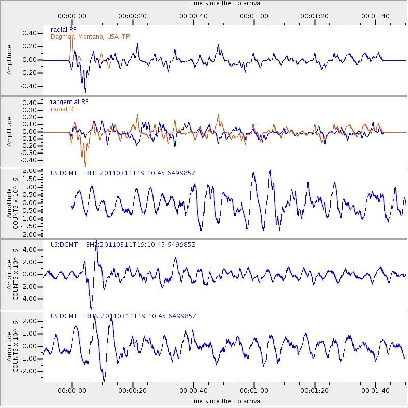
DGMT Dagmar, Montana, USA - Earthquake Result Viewer
*The percent match for this event was below the threshold and hence no stack was calculated.
| Earthquake location: |
Near West Coast Of Honshu, Japan |
| Earthquake latitude/longitude: |
37.0/138.4 |
| Earthquake time(UTC): |
2011/03/11 (070) 18:59:16 GMT |
| Earthquake Depth: |
9.3 km |
| Earthquake Magnitude: |
6.1 MB, 6.1 MS, 6.3 MW, 6.2 MW |
| Earthquake Catalog/Contributor: |
WHDF/NEIC |
|
| Network: |
US United States National Seismic Network |
| Station: |
DGMT Dagmar, Montana, USA |
| Lat/Lon: |
48.47 N/104.20 W |
| Elevation: |
0.0 m |
|
| Distance: |
78.3 deg |
| Az: |
37.094 deg |
| Baz: |
313.498 deg |
| Ray Param: |
$rayparam |
*The percent match for this event was below the threshold and hence was not used in the summary stack. |
|
| Radial Match: |
65.755165 % |
| Radial Bump: |
400 |
| Transverse Match: |
67.96321 % |
| Transverse Bump: |
400 |
| SOD ConfigId: |
356183 |
| Insert Time: |
2011-08-17 23:39:09.222 +0000 |
| GWidth: |
2.5 |
| Max Bumps: |
400 |
| Tol: |
0.001 |
|
Signal To Noise
| Channel | StoN | STA | LTA |
| US:DGMT: :BHZ:20110311T19:10:45.649985Z | 2.120652 | 8.052059E-7 | 3.7969733E-7 |
| US:DGMT: :BHN:20110311T19:10:45.649985Z | 2.3899174 | 1.0502387E-6 | 4.3944559E-7 |
| US:DGMT: :BHE:20110311T19:10:45.649985Z | 0.69486123 | 3.5336527E-7 | 5.085408E-7 |
| Arrivals |
| Ps | |
| PpPs | |
| PsPs/PpSs | |


