You are here: Home > Network List > US - United States National Seismic Network Stations List
> Station EGMT Eagleton, Montana, USA > Earthquake Result Viewer
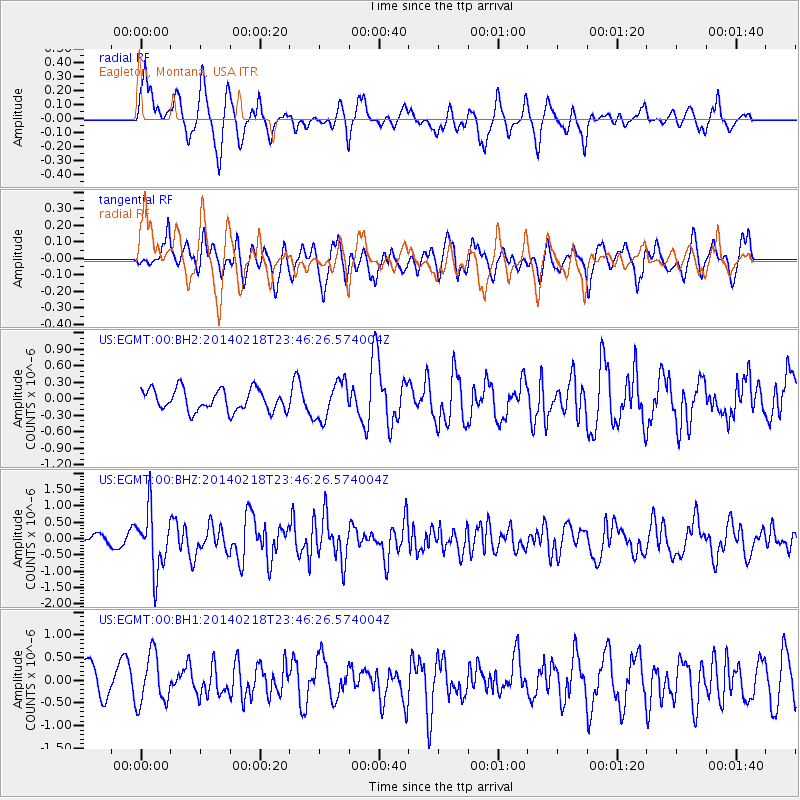
EGMT Eagleton, Montana, USA - Earthquake Result Viewer
*The percent match for this event was below the threshold and hence no stack was calculated.
| Earthquake location: |
Near Coast Of Peru |
| Earthquake latitude/longitude: |
-14.2/-75.6 |
| Earthquake time(UTC): |
2014/02/18 (049) 23:35:58 GMT |
| Earthquake Depth: |
57 km |
| Earthquake Magnitude: |
6.0 MWB, 5.9 MWW, 5.9 MWC, 6.0 MWC |
| Earthquake Catalog/Contributor: |
NEIC PDE/NEIC COMCAT |
|
| Network: |
US United States National Seismic Network |
| Station: |
EGMT Eagleton, Montana, USA |
| Lat/Lon: |
48.02 N/109.75 W |
| Elevation: |
1055 m |
|
| Distance: |
69.0 deg |
| Az: |
336.188 deg |
| Baz: |
144.312 deg |
| Ray Param: |
$rayparam |
*The percent match for this event was below the threshold and hence was not used in the summary stack. |
|
| Radial Match: |
67.87774 % |
| Radial Bump: |
400 |
| Transverse Match: |
59.785057 % |
| Transverse Bump: |
400 |
| SOD ConfigId: |
3390531 |
| Insert Time: |
2019-04-10 09:25:17.482 +0000 |
| GWidth: |
2.5 |
| Max Bumps: |
400 |
| Tol: |
0.001 |
|
Signal To Noise
| Channel | StoN | STA | LTA |
| US:EGMT:00:BHZ:20140218T23:46:26.574004Z | 6.09793 | 9.278109E-7 | 1.5215177E-7 |
| US:EGMT:00:BH1:20140218T23:46:26.574004Z | 1.6782675 | 5.4832884E-7 | 3.2672315E-7 |
| US:EGMT:00:BH2:20140218T23:46:26.574004Z | 1.7228681 | 3.349156E-7 | 1.9439423E-7 |
| Arrivals |
| Ps | |
| PpPs | |
| PsPs/PpSs | |


