You are here: Home > Network List > TA - USArray Transportable Network (new EarthScope stations) Stations List
> Station R29A Marienthal, KS, USA > Earthquake Result Viewer
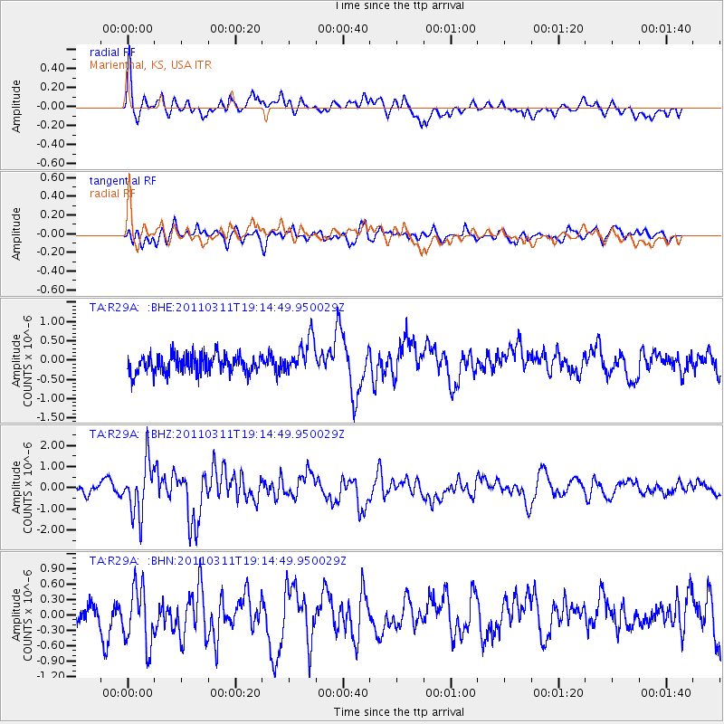
R29A Marienthal, KS, USA - Earthquake Result Viewer
*The percent match for this event was below the threshold and hence no stack was calculated.
| Earthquake location: |
Near East Coast Of Honshu, Japan |
| Earthquake latitude/longitude: |
39.3/142.9 |
| Earthquake time(UTC): |
2011/03/11 (070) 19:02:59 GMT |
| Earthquake Depth: |
27 km |
| Earthquake Magnitude: |
6.1 MB, 6.2 MS, 6.0 MW |
| Earthquake Catalog/Contributor: |
WHDF/NEIC |
|
| Network: |
TA USArray Transportable Network (new EarthScope stations) |
| Station: |
R29A Marienthal, KS, USA |
| Lat/Lon: |
38.42 N/101.14 W |
| Elevation: |
957 m |
|
| Distance: |
82.9 deg |
| Az: |
45.358 deg |
| Baz: |
315.376 deg |
| Ray Param: |
$rayparam |
*The percent match for this event was below the threshold and hence was not used in the summary stack. |
|
| Radial Match: |
60.8432 % |
| Radial Bump: |
400 |
| Transverse Match: |
55.521587 % |
| Transverse Bump: |
400 |
| SOD ConfigId: |
356183 |
| Insert Time: |
2011-08-18 01:11:41.658 +0000 |
| GWidth: |
2.5 |
| Max Bumps: |
400 |
| Tol: |
0.001 |
|
Signal To Noise
| Channel | StoN | STA | LTA |
| TA:R29A: :BHZ:20110311T19:14:49.950029Z | 4.1729474 | 1.2493821E-6 | 2.994004E-7 |
| TA:R29A: :BHN:20110311T19:14:49.950029Z | 1.9147198 | 5.904773E-7 | 3.0838837E-7 |
| TA:R29A: :BHE:20110311T19:14:49.950029Z | 1.9762622 | 4.7227664E-7 | 2.3897468E-7 |
| Arrivals |
| Ps | |
| PpPs | |
| PsPs/PpSs | |


