You are here: Home > Network List > TA - USArray Transportable Network (new EarthScope stations) Stations List
> Station N29A Votaw Ranch, Wellfleet, NE, USA > Earthquake Result Viewer
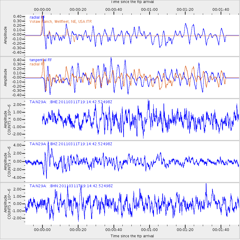
N29A Votaw Ranch, Wellfleet, NE, USA - Earthquake Result Viewer
*The percent match for this event was below the threshold and hence no stack was calculated.
| Earthquake location: |
Near East Coast Of Honshu, Japan |
| Earthquake latitude/longitude: |
39.3/142.9 |
| Earthquake time(UTC): |
2011/03/11 (070) 19:02:59 GMT |
| Earthquake Depth: |
27 km |
| Earthquake Magnitude: |
6.1 MB, 6.2 MS, 6.0 MW |
| Earthquake Catalog/Contributor: |
WHDF/NEIC |
|
| Network: |
TA USArray Transportable Network (new EarthScope stations) |
| Station: |
N29A Votaw Ranch, Wellfleet, NE, USA |
| Lat/Lon: |
40.82 N/100.63 W |
| Elevation: |
897 m |
|
| Distance: |
81.5 deg |
| Az: |
43.379 deg |
| Baz: |
315.432 deg |
| Ray Param: |
$rayparam |
*The percent match for this event was below the threshold and hence was not used in the summary stack. |
|
| Radial Match: |
63.001396 % |
| Radial Bump: |
400 |
| Transverse Match: |
62.32344 % |
| Transverse Bump: |
400 |
| SOD ConfigId: |
356183 |
| Insert Time: |
2011-08-18 01:14:45.033 +0000 |
| GWidth: |
2.5 |
| Max Bumps: |
400 |
| Tol: |
0.001 |
|
Signal To Noise
| Channel | StoN | STA | LTA |
| TA:N29A: :BHZ:20110311T19:14:42.52498Z | 6.295802 | 2.1224703E-6 | 3.3712467E-7 |
| TA:N29A: :BHN:20110311T19:14:42.52498Z | 1.2736818 | 7.007172E-7 | 5.501509E-7 |
| TA:N29A: :BHE:20110311T19:14:42.52498Z | 2.0115297 | 1.1415393E-6 | 5.674981E-7 |
| Arrivals |
| Ps | |
| PpPs | |
| PsPs/PpSs | |


